View Capital Bikeshare in a larger map
UPDATE: Well, they call it “proposed” for a reason: DDOT is still making some adjustments based on feedback. It appears like a formal release is on its way this afternoon. We’ll update our links when DDOT officially finalizes the map. Our post now reflects the latest information from DDOT.
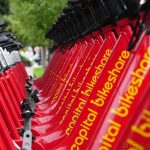
DDOT has released this map of its proposed locations for the Capital Bikeshare program, which will build upon the success of the SmartBike DC program to increase the number of available shared bikes from 100 to over 1,100. The expansion is scheduled to be completed by this fall.
As far as the map goes, it represents a fairly comprehensive selection, if obviously clustered downtown — it wouldn’t make much sense to spread the bike stations too far apart, as usage of any given station is based mostly on its proximity to any other given station. That said, the sites on the outer ring of the system will work, because they are at places where an audience for bike-sharing exists — stations are proposed at universities like American, Gallaudet, Georgetown and Catholic, at Metro stations like Tenleytown and Stadium-Armory, and in small bunches — for example, there are 11 proposed stations east of the Anacostia: three in Deanwood, three in Barry Farm and the rest at major intersections. There’s even a station on the Mall.
There’s always going to be holes, but as far as we’re concerned, this is a pretty good effort. Gripes? Leave ’em in the comments.