Martin Austermuhle
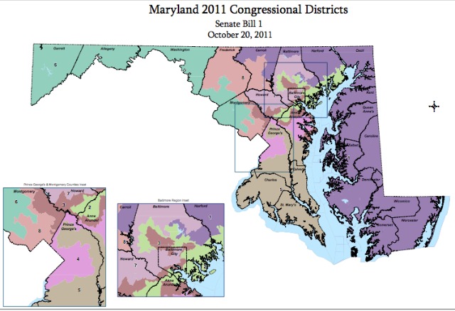
In politics, everyone knows that whichever political party is in power around the time of each decennial census wields huge amounts of power — they get to control the re-drawing of their state’s political map, including congressional districts. The process often produces districts that meander aimlessly across large swaths of land to accommodate certain lawmakers while punishing others, and for 2011, there was no bigger offender than Maryland.
Annapolis newspaper The Capital reported earlier this week that the Old Line State has claimed the dubious distinction for having produced some of the “least compact and most gerrymandered congressional districts in the nation.”
According to the paper, a Philadelphia firm has gone about quantifying “compactness” for the congressional districts in the 28 states that have finalized their maps, where a higher number represents more compact district. While the 27 states other than Maryland average came in at 0.231, Maryland came in at 0.1225, with the least compact district — the fightin’ third — hitting .0333. That district is so bad, it seems, that a federal judge called it “a Rorschach-like eyesore.” You can see the new map of congressional districts here.
During the controversial fall 2011 redistricting, Rep. Donna Edwards (D-MD) and a number of Montgomery County officials came out against their party’s moves in Annapolis. Edwards complained that Montgomery County — which is majority minority — would be split up into three district, all likely represented by white men.
Regardless of how foolish the congressional map may look, it passed muster with a three judge panel in December.