Martin Austermuhle
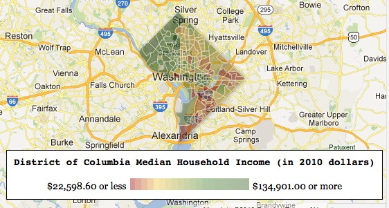
News flash: D.C. remains a divided city, with richer residents largely living west of Rock Creek Park and poverty increasing has you head east away from it. And as we learned in the past, those divisions extend to crime, with the majority of killings taking place on the eastern end of the city.
The Rich Blocks, Poor Blocks web tool allows you to see that on a granular level: by Census tract. (The tool uses data from 2006 to 2010.) It’s an interesting way to see where you and your neighbors are relative to people just a few streets or miles away. In my case, for one, my north Columbia Heights tract has a median income that’s $100,000 lower than our compatriots in Crestwood, just across 16th Street.
The maps aren’t just for D.C., but you can look at just about any city in the country. And as the City Paper notes, we’re much more divided than most.