 Rachel Sadon
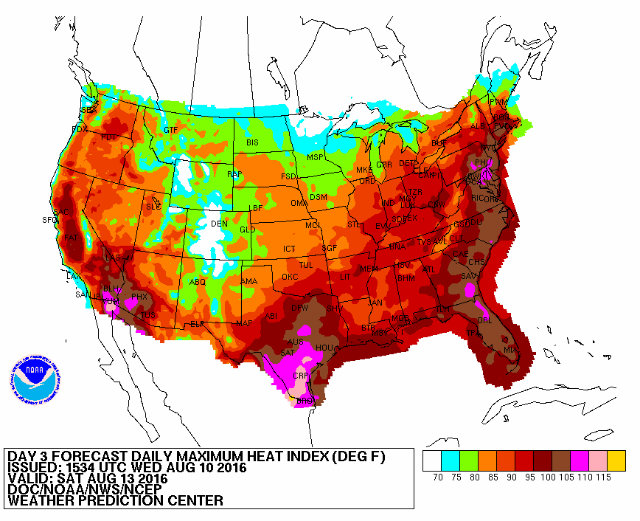 (Courtesy of NOAA/NWS)
The perpetual bearers of weekend-ruining news over at the National Weather Service have issued a hazardous weather outlook that indicates a “hot and humid airmass” is heading our way. Insert Donald-Trump-is-a-bloviating-asshat joke here and move on.
Steamy air is gearing up to punch you in the face, with heat indices (the way the temperature feels when taking into account the heat and humidity) between 100 and 105 degrees from Thursday through Tuesday. And all that heat and humidity will lead to storms that are likely to involve heavy rainfall, and possibly flash flooding, according to NWS.
The perpetual bearers of poetic weather warnings over at the Capitol Weather Gang put it this way: “oppressively steamy air to smother Northeast Interstate 95 corridor into the weekend.” Temperatures might not reach the levels of the heat dome hell we endured last month, but the index values are likely to stay high for a longer period of time and over more territory, according to CWG.
CWG better get its thesaurus out, too, because a recent study from Climate Central found that D.C. will see an increase in days with a heat index higher than 105 degrees in the years to come.


