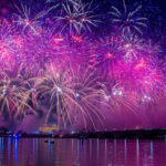
This year’s Independence Day fireworks are scheduled to begin at 9:10 p.m. (Hopefully, the weather will cooperate.) But do you know how you’ll be getting to and from the District’s most coveted viewing locations?
Well, the District government (and the rest of us living here) would really prefer it if you used public transportation or walked, rather than driving – as one might suspect, there’s going to be all sorts of stringent road restrictions going on throughout most of the day tomorrow. We figured we’d throw together a little Google Map to show you exactly how big of a challenge navigating in a car can be on the most Washingtonian of holidays. In the map, a red line indicates a total street closure starting at 6 a.m., and a gray line indicates a street which will have complete parking restrictions beginning at 5 a.m.
A couple of exceptions: The 9th Street Tunnel and the 12th Street Tunnel will remain open except during the Independence Day Parade, which will begin at approximately 11:45 a.m. and continue until approximately 2:30 p.m. 3rd and 14th Streets between Constitution and Independence will be closed from 11:30 a.m. onwards.
Oh, and for you Virginians, we didn’t forget the bridges: the Arlington Memorial Bridge will be closed all day, in order to facilitate foot traffic around the Mall. The 14th Street Bridge and the Roosevelt Bridge will both be open, but “closely monitored” in case there’s safety concerns after the fireworks start. And in case you think tomorrow’s any different than another day, parking and stopping on any bridge during the day tomorrow is just as big a no-no as it is at any other time.
Also, remember that there are no bikes allowed on any Metro trains tomorrow, and that the Smithsonian station is closed all day for security purposes.