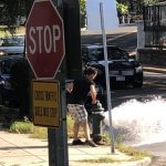
 Find out! DC WASA has developed a Google Earth-based fire hydrants file for the whole city, showing where in- and out-of-service hydrants are. Their web site has the Google Earth KMZ file, as well as a help document on how to use it (basically, just add it to Google Earth). The pink dots are the non-working hydrants and the purple ones are the working ones. It’s kind of busy, with hydrant number labels all over the place, but hey, it’s available.
You can report a problem with a hydrant via the Google Earth file, which is pretty cool, and their website also gives their hydrant problem emergency number, (202) 612-3400.
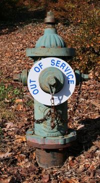
Browsing the city, it looks like there’s a hundred or so out of service, with clusters in the Bloomingdale/Sursum Corda area, Penn Quarter, and around Fort Reno. Most of the hydrants are listed as working around the scenes of some recent notable fires, like the Georgetown Library, Eastern Market, Adams Mill Road, and Mt. Pleasant Street NW. How does your neighborhood fare?
Photo by sally henny penny