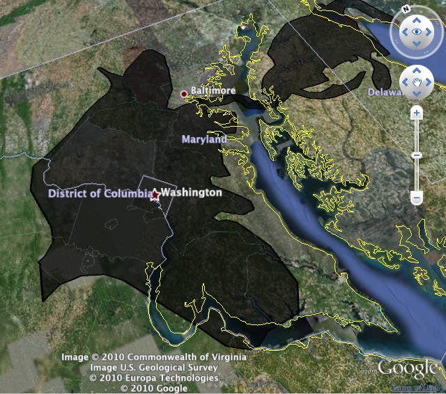
The Atlantic’s James Fallows points us to this Google Earth-powered tool from Paul Rademacher that allows users to overlay the size of the Deepwater Horizon spill over any metropolitan area. Placing the image of the spill over the D.C. metro area provides a stunning look at just how big this disaster really is.
In this case, Rademacher, who works for Google Earth, points out on his site that it is very hard to imagine the scale of things we see in the open ocean. Suddenly it becomes much more comprehensible and dramatic when mapped this way.