 Photo by Michael Grass
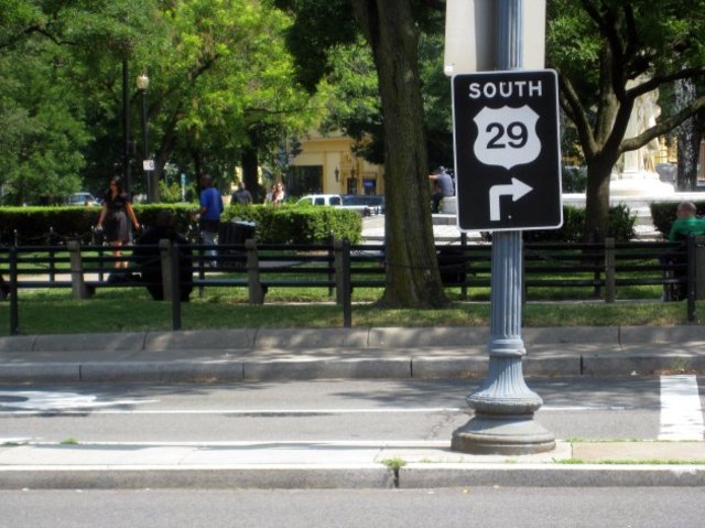
Have you ever walked around the perimeter of Dupont Circle and seen signs for Route 29? Yes, part of the U.S. Highway System runs around the circle and to distant parts of the nation via New Hampshire Avenue if you read the signs. Except that it doesn’t!
Route 29’s path through the nation’s capital was shifted decades ago away from New Hampshire Avenue and 16th Street NW, but for whatever reason, the signs have remained posted at the circle. (Technically, Route 29 runs from the Key Bridge to Georgia Avenue via the Whitehurst Freeway, K Street NW, 11th Street NW and Rhode Island Avenue.)
I wrote about these signs for DCist five years ago. Five years! In recent months, I decided to take another look at this most-pressing issue facing the District of Columbia. If the city was doing such good rapid response on pothole repair via Twitter, it shouldn’t really be that big of an issue to tweet a request to have the signs removed. Right? So back in March, I decided to conduct a social media experiment to see how quickly my average citizen request would receive attention. (Look, even The Washington Post is doing something similar now with its Daily Gripe!
Long story short, the Route 29 signs are still posted.