Martin Austermuhle
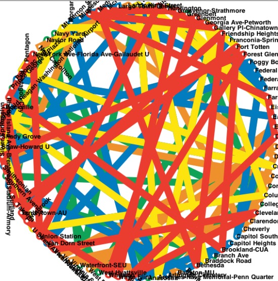
This image may look like something you’d find in a small modern art gallery. It’s anything but — it’s a Metro map, creatively distorted for a world in which our existing Metro system maintained the lines and connections it currently has but every station was laid out in a circle.
Friend of DCist, Flickr contributor and programmer M.V. Jantzen tipped us off to an interactive little project he’s recently put together — a Metro map distorter. He explains:
The Washington region’s iconic Metorail map is a topological map that plays with scale in order to efficiently display the lines and the stations. I created my own map which allows you to play with other distortion schemes.
With just a few touches of a button, you can straighten out the Blue Line, switch the Red and Blue lines, overlap or rotate end stations, form concentric circles or reverse the Orange Line. Best yet, he’s developed a Pac-Man game in which the star character and the ghosts move along the different Metro lines eating the various stations. He explains everything here.
It’s a fascinating way to kill some time and imagine what Metro could be like if you were an emperor with a soft spot for transit planning.