
As the Atlantic hurricane season hits its stride, meteorologists are barreling through this year’s list of storm names. The last remnants of Hurricane Isaac are now dissipating somewhere over the Northeast United States after bearing down last week on the Gulf Coast.
The following system, Tropical Storm Joyce, formed August 20 on the heels of Isaac, producing thunderstorms over the seas between mainland Africa and Cape Verde. It died a quick death.
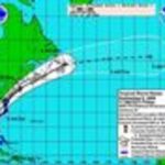
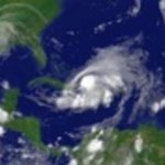
As did the next storm, though its name lent itself to perhaps the most hilarious weather forecast we’ve ever seen. Tropical wave 11—Kirk—was first spotted August 22 as a low-pressure system moving off the African coast. It reached hurricane strength last Thursday, and by Friday was a Category 2 storm.
But Kirk stopped its progress about halfway between Africa and North America. By Sunday evening, it was downgraded to a post-tropical cyclone. The nation’s hurricane monitors at the National Oceanic and Atmospheric Administration transmitted one final report announcing that Kirk posed no threat to land. But they did so in what can only be considered a truly epic manner:
KIRK IS NOT EXPECTED TO LIVE LONG AND PROSPER. VISIBLE SATELLITE IMAGES AND A 1214 UTC ASCAT PASS INDICATE THAT THE SYSTEM STILL HAS A CLOSED CIRCULATION BUT IT IS BECOMING ELONGATED. MAXIMUM
RELIABLE WINDS IN THE ASCAT PASS WERE AROUND 45 KT SO THE INITIAL WIND SPEED IS HELD AT THAT VALUE. KIRK WILL LIKELY BECOME POST-TROPICAL LATER TODAY OR DISSIPATE JUST BEFORE IT MERGES WITH A FRONT THAT IS CURRENTLY LOCATED ABOUT 200 N MI TO ITS WEST.
Oh, yes. They went there. A storm sharing its name with the greatest space commander the galaxy will ever know was dismissed with unfeeling Vulcan logic.
Is it too early to mount a campaign to have next year’s 11th tropical cyclone be named Khan? If it peters out, NOAA can boast of “laughing at the superior intellect.” Or, should a prospective Hurricane Khan pose a threat to an inhabited area, we’ve got a pretty good idea of what the lede for the weather alert could be.