Martin Austermuhle
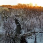
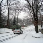
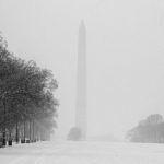
For all the predictions of a snowy winter, the last few months have been a total bust. But a coming storm that’s set to hit the area this Tuesday and Wednesday could well dump more snow on us in one go than we’ve had in either of the last two winters.
According to the Capital Weather Gang, there’s a very good chance we’ll get two or more inches of snow overnight Tuesday and into Wednesday, but that we shouldn’t discount more than that—under current models, there’s between a 45 and 60 percent chance that more than five inches of snow will fall. This is how NBC4 expects the storm will play out:
The storm will begin as rain Tuesday, changing into snow after midnight in some areas. By dawn Wednesday, the entire region should be seeing snow, which will continue to fall throughout the day and possibly through dawn Thursday.
Temperatures will be in the low or mid 30s.
The heavy, wet snow could lead to power outages, the National Weather Service warns.
This isn’t insignificant—fewer than two inches of snow have fallen on the city this winter, and you’ve really got to look back to at least 2011 for any snowfall of note.
The Capital Weather Gang has already named the upcoming storm: Snowquester. While certainly topical, I’ll go ahead and point out that it doesn’t really make sense. Snowquester would imply that we’ve had a bunch of snow and that it’s now suddenly—and senselessly—stopping. It’s been just the opposite for D.C. over the last two; it’s been nothing but snow frugality in these parts, and only now are we in for a little snow binge to make us feel better about winter. If you’ve got any better names, leave them in the comments.