Photo by kimberlyfaye
Based on the temperature in D.C. right now (46 degrees fahrenheit at the time of writing), you may not think that frigid temperatures and the possibility of up to six inches of snow are coming tomorrow, but you’d be wrong. Dead wrong.
According to the National Weather Service, a winter storm watch (update: now it’s a warning!) is in effect for the D.C. and Baltimore areas from late tonight through tomorrow evening. NWS says there’s a potential for five inches or more of snow, with the heaviest precipitation set to occur tomorrow morning through midday. Even the very cautious Capital Weather Gang says “most of the area has a good chance of 4″ or even more Tuesday.”
And to make matters worse, this snow storm is set to hit right when a second polar vortex is making its frosty return to the D.C. area. Temperatures will dip into the 20s early tomorrow morning, with winds that’ll make it feel like it’s in the teens. NWS says there will be 10 to 15 mph winds, with gusts around 25 mph, thus blowing the snow around making the roads all the more dangerous.
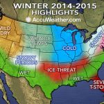
But it gets worse! AccuWeather says that an Alberta Clipper is slated to hit on Thursday, bringing the chance for a little more snow along with more frigid temperatures later this week and weekend. So yeah, stock up on supplies, bundle up, and prepare to hunker down inside for the rest of the week.
*Update/Clarification: As The Weather Channel points out, tomorrow’s blast of cold air—as well as the frosty chill we experienced at the beginning of the month—isn’t actually a polar vortex and the term has been misused (by us, among many other publications). From The Weather Channel:
There’s even been some more chatter about the “polar vortex”, which became a popular catchphrase to describe the blast of bitter cold air at the start of the month. However, just like in early January, this term is being used misleadingly from a meteorological perspective since the actual center of the Northern Hemisphere polar vortex never really moves through the atmosphere above the United States – rather, it remains anchored farther to the north.
The cold air we’re experiencing tomorrow (and what we experienced a few weeks ago) is actually a result of the real polar vortex getting weaker and thus sending cold air southward.