 Via DDOT.
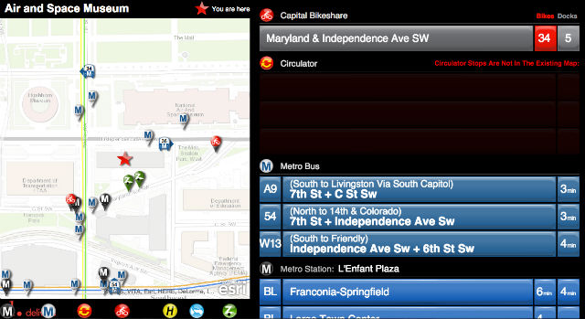
The new Ride D.C. tool from the city’s Department of Transportation shows which forms of public transit are available within a two- to six-minute walking radius from a certain address.
While the tool was designed for businesses, there’s nothing stopping your from typing in your home address. From the site:
The RideDC Portal Dashboard was conceptualized to provide D.C. retail establishments with a web-based tool that would allow users to easily create their own “custom” dashboard to display a dynamic map of transit options near their establishment. The RideDC Portal Dashboard provides near real-time information about multi-modal transportation options and locations on the map. The portal displays:
Metro Bus / DC Circulator schedules and Nextbus updates Metrorail arrival predictions Capital Bikeshare bike and open dock availability Caresharing location and car availability The custom dashboard [is] expected to be [displayed] on a monitor near the exit of the retail establishment or somewhere easily accessible to visitors of the establishments, offering the clients near real-time transportation options for their next destination.
According to DDOT, an app version will follow in January. Suggestions? Send them this way.