 Photo by IntangibleArts.
By DCist Contributor Becky Little
You can’t really talk about how D.C. is changing without mentioning the “G” word. Gentrification. “Is D.C. still Chocolate City?” was the subject of a recent panel hosted by the Martin Luther King, Jr. Public Library as part of its Black History Month programming. It’s a question that’s been at the forefront of the discussion of a changing city, especially in certain neighborhoods that have seen rapid change in recent years. But the cultural and racial history of some of those gentrifying neighborhoods may be different than what was previously thought. For the past year and a half, local historians Mara Cherkasky and Sarah Shoenfeld have been pulling a forgotten story about the history of segregation in the District out of the D.C. archives.
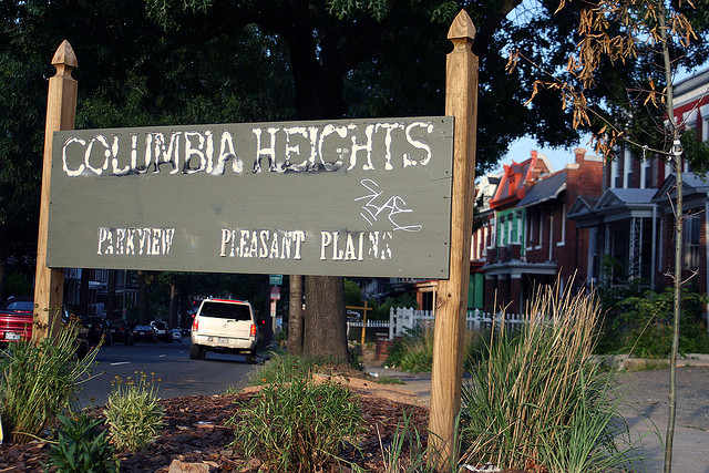
Through their ongoing project, Mapping Segregation in Washington D.C., they’ve uncovered that the Bloomingdale and Park View neighborhoods—today thought of as historically black—were once designated as white-only. In these and other neighborhoods like Columbia Heights and Mount Pleasant, segregation was enforced by clusters of housing deeds and neighborhood petitions.
D.C. historians knew that these racially restrictive agreements existed; but until this project, no one had yet documented their reach. So far, Cherkasky and Shoenfeld have identified about 7,000 properties subject to these agreements, most of them executed between the 1880s and 1940s. Cherkasky, who discovered some of these agreements while working on other projects, said her discovery of these agreements were quite surprising. “Nobody really knew how extensive these things were. It was all anecdotal.”
The response to their research has been significant, especially considering that this is a grant-funded project with a small staff. When Cherkasky and Shoenfeld presented their findings at the Mount Pleasant library earlier this year, Shoenfeld’s mom counted over 150 attendees.
“When we first wrote the grant [for this project], we had to put how many people we thought we would reach,” she said. “And I thought, ‘Well, we can’t put 5. Maybe 100?’”
Cherkasky and Shoenfeld decided to start the project around the same time that they formed their company, Prologue DC, under which they both do freelance work. Though their colleague Brian Kraft is not part of Prologue DC, he has worked on the Mapping Segregation project since its beginning.
As a historian and GIS specialist, Kraft’s role in the project is to display Cherkasky and Shoenfeld’s research visually, by using GIS mapping to create an online story map.
“This is a huge story, not just for the District, but in U.S. history,” said Kraft. “I’m very interested in mapping historical data, and it seemed to me that that could be done here; that that technique could be applied to this story, so that we could have a deeper understanding of segregation.”
So far, the group has presented most of their research through public lectures. But tonight, they’ll launch their online story map on Prologue DC’s website, which will visually present their findings about segregation in D.C.
“When you see the restricted lots that we’ve documented, when you see the location of the legal cases, when you see the demographics, where people of different races lived—I think it’s very powerful,” Kraft said.
Mapping Segregation hopes to expand their story map to include other neighborhoods, like historic Anacostia and Petworth, both of which were at one time exclusively white.
They also hope to study the history of schools and recreation facilities. Cherkasky has already looked into the history of the Park View elementary school park, which, as more African Americans moved to the neighborhood in the 1940s, switched from being a white park to a black park (in between the shift, it was a mixed-use park, open to black children only after 3:00pm).
Cherkasky, Shoenfeld, and Kraft are interested in expanding the project because they each have a deep personal interest in the research. But they also know that the project has important implications for racial and housing issues today.
“I think D.C. is changing a lot right now demographically,” said Shoenfeld. “People are very interested in the history of their neighborhoods, but also don’t know about this history … And newcomers moving into these neighborhoods aren’t aware of what the underlying issues are.”
In a neighborhood like Bloomingdale, which African Americans had to struggle to move into, “to watch it finally get some amenities that people have been wanting for many years as whites begin moving back into these neighborhoods—it’s created a lot of tension,” she said.
To illustrate her point, Shoenfeld referenced the Bloomingdale flood project, which will help ease the effects of the neighborhood’s frequent flooding. It’s frustrating to some, she said, “that that’s happening there [now], versus forty years ago.”
In the context of issues like the flood project, her research is “useful to know about,” she said. “And I think [our research] maybe just gives people hopefully better understanding of why tension might exist in D.C. neighborhoods.”
Cherkasky and Shoenfeld will present the latest findings in Mapping Segregation tonight at 6:30 p.m. in the Great Hall of the Martin Luther King Jr. Memorial Public Library (901 G Street NW).