Rachel Kurzius
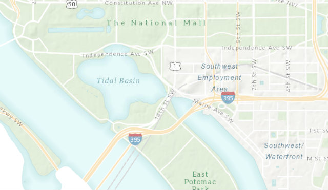
 Image courtesy of D.C. GIS.
Location, location, location—the three most important factors to consider in real estate. And also when competing in a series of complicated riddles on D.C. GIS Day, which is today.
GIS stands for Geographic Information Systems. “It’s all about location, and tying everything to a spatial location,” explains Alexandre Santos, a geospacial specialist with the Office of the Chief Technology Officer.
OCTO is celebrating the international GIS Day to “create awareness and show off our spatial tools,” Santos says. “We started with the idea of a virtual scavenger hunt, but it turned into an ‘are you smarter than D.C. GIS’ series of riddles.”
For instance, OCTO released this sample question yesterday:
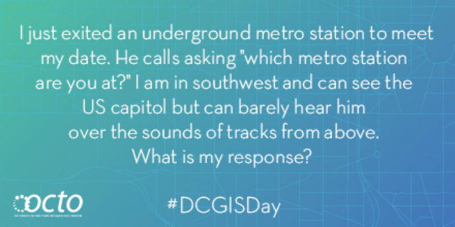 Image courtesy of D.C. OCTO.
The answer is L’Enfant Plaza.
If you found that one easy, Santos says the questions “get progressively harder. Some will require analysis and the use of tools we have available. This is not just trivia, where anyone can Google a question and get an answer. We want to steer people towards mapping tools.”
Building awareness about D.C.’s resources is important, says OCTO Communications Director Mike Rupert, because “data can drive much of our decisions, from government to education to allocation of resources. And D.C. is one of the few municipalities that shares our data publicly. Plus, we have years worth of images of the city.”
To play along with D.C. GIS Day, follow the hashtag #DCGISDay or RSVP on the Facebook event page. The questions start at 11 a.m., and OCTO has compiled a series of maps to help participants.