 Rachel Sadon
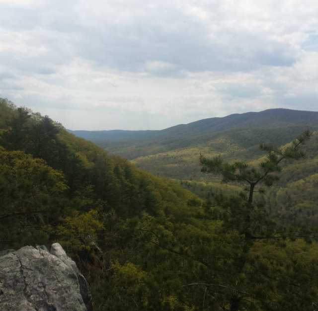
When the heat and political tirades and Metro breaking down all just get to be too much, these are the places we hightail it to for a walk—of varying degrees of strenuousness—in nature. Many of them require a drive, but there are also a fair number of public transportation-accessible trails. For more ideas, see these outdoor getaways and weekend trips (some of which are included below).
 (Photo by RISS311)
OLD RAG MOUNTAIN: When a friend casually solicits suggestions—whether it be in person or via social media—for good weekend getaway, one of the more popular answers is the Shenandoah Valley. Sure, the Shenandoah Valley is gorgeous, but it’s also damn big. Writing “go to the Shenandoah Valley” when a friend on Facebook asks for weekend getaways isn’t exactly helpful. You might as well be saying “go to Virginia.” So, I’d like to point out a specific part of the vast valley area that’s worth your time: Old Rag Mountain. Located in the Blue Ridge Mountains, a mere two-and-a-half hour drive from D.C. (depending on traffic), hiking up the 3,284-foot mountain is about six miles—some of it quite rocky terrain. Not only does the top of the mountain have some of the most breathtaking views I’ve ever seen, but there’s a few camping sites prime for an overnight stay atop Old Rag. — Matt Cohen
Old Rag Mountain is 92 miles from Washington, D.C.
 (Photo by Rachel Sadon)
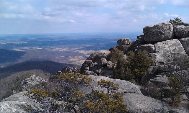
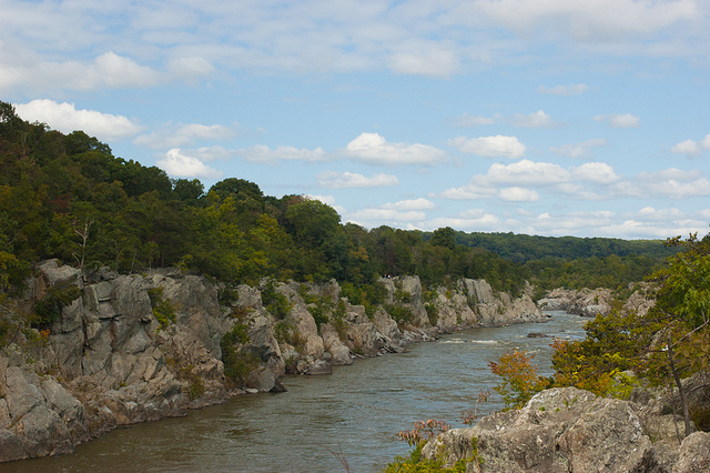
BUZZARD ROCK: Again, telling someone to go out to the George Washington and Jefferson National Forests is pretty useless. But here’s our specific pick: a four-ish-mile hike up to the spectacular ridge views of Buzzard Rock. The hike itself is often described as a short two miles, but it takes a bit more than two miles to get to the trailhead from the parking lot at the Elizabeth Furnace Recreation area (during which you’ll get an interesting lesson in pig iron as you walk past the ruins of old blast furnaces)—and then there’s still the way back, so it’s a plenty robust eight-mile day hike, round trip. Although its a bit further out (near Front Royal, Va.), it is well worth the drive for the solitude you’ll likely get to enjoy once you make it out there. When I went on a beautiful mid-May day last year, we encountered a total of four other hikers and a handful of rock climbers headed up the ridge. Plus the name isn’t an anomaly; you’re likely to spot hawks soaring through the verdant valley. — Rachel Sadon
Buzzard Rock is about 84 miles from Washington, D.C. Find hike details here.
 (Photo by Richard Ricciardi)
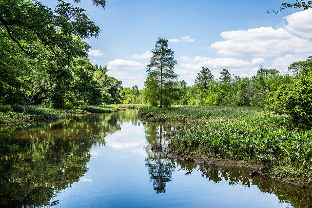
THEODORE ROOSEVELT ISLAND: For those looking for a nice stroll or hike in the greet outdoors, Roosevelt Island is a great option. Located in the Potomac River, the 88.5-acre island features a statue of America’s 26th president, as well as many trails. Pedestrians may only enter the island from a footbridge in Rosslyn, while drivers enter from the George Washington Memorial Parkway. While pets are welcome, bikes are not. Bonus for locals? It’s one of the least visited tourist attractions in the area. — Sarah Anne Hughes
Theodore Roosevelt Island is located in the Potomac River. It is accessible from the downstream side of the Key Bridge in Virginia.
 (Photo by Caroline Angelo)
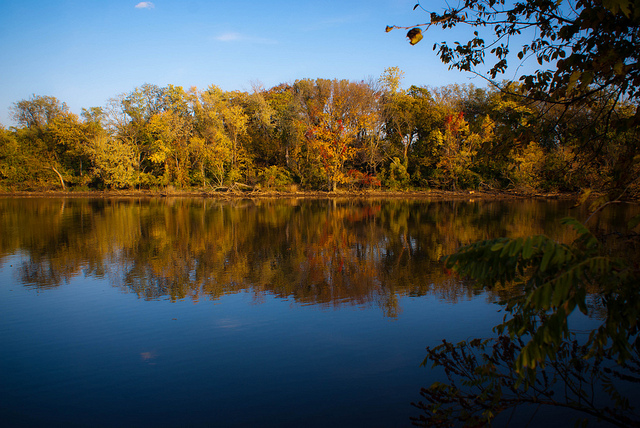
KINGMAN ISLAND: Most people only head out to Kingman Island once a year, for the annual bluegrass festival. But, in addition to a fascinating history, there are also several miles of trails to explore some of the prettiest wilderness in D.C. proper. —Rachel Sadon
Kingman Island is accessible by taking Metro to the Stadium-Armory station
 (Photo by Nikoo Yahyazadeh)
THE BILLY GOAT TRAIL AT GREAT FALLS PARK: The Billy Goat Trail is a great way to spend a couple of hours on a nice day, especially if you go early enough to avoid the crowds. Parts of the hike can be technical, as there is some rock scrambling involved. But the “A” section of the trail only takes a couple of hours, is a great workout, and offers some wonderful scenic views of the Potomac River. Great Falls is just outside the city, so early risers can be back home by lunch time. — Sarah Anne Hughes
The Great Falls Tavern Visitor Center is located 11710 MacArthur Blvd. in Potomac, Md.
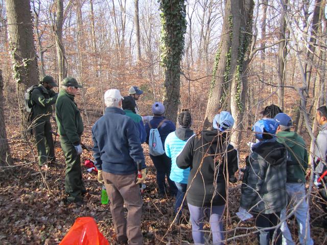 Photo by Sarah Anne Hughes.
FORT DUPONT PARK: Located just over the Anacostia River, Fort Dupont Park features trails friendly to a non-hiker, gardens, and a pavilion that hosts a summer concert series. Like Rock Creek Park, Fort Dupont offers a chance to feel immersed in the wilderness while inside the city limits. — Sarah Anne Hughes
Fort Dupont Park’s parking lot is located at 3600 F Street SE.
 (Photo by Katie Yaeger Rotramel)
NATIONAL ARBORETUM: Calling this a hike is a bit of a stretch, but there are some hills and you can definitely walk yourself silly without having to leave the confines of the city. I particularly enjoy how the landscape changes and opens up depending on which part of the park you’re in. And yes, this is where those extremely photogenic Capitol Columns are located. — Rachel Sadon
The National Arboretum is located at 3501 New York Ave NE
 (Photo by John J Young)
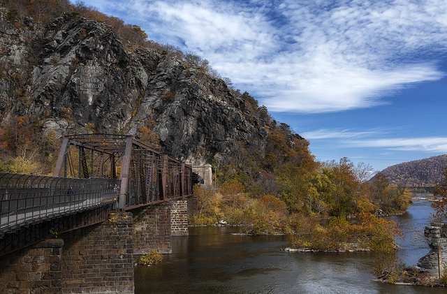
HARPERS FERRY: Thomas Jefferson said that “The passage of the Patowmac through the Blue Ridge is perhaps one of the most stupendous scenes in Nature” and he’s not wrong—Harpers Ferry boasts some gorgeous vistas any time of year. As the midway point for Appalachian Trail thru hikers, the town has a small museum dedicated to the history of the trail and, of course, ample access to the AT itself. And it’s also right on the C&O Canal Trail, which can lead you to difficult hikes with huge, historic cannons at some of the plateaus. If you’re really going for the gold, you could bike here from D.C. and then brag about it for years to come. —Rachel Kurzius
Harpers Ferry is about 63 miles from D.C.
 (Photo courtesy of NPS)
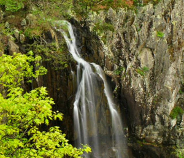
OVERALL RUN FALLS TRAIL: Shenandoah has a lot of incredible hikes, but my favorite by far has got to be Overall Run. It begins strenuously, in such a way that you’ll wonder “What the hell did I get myself into?” And then, a mile or two in, you begin to reap the rewards. The terrain levels out and you get to scope marvelous views and stand under a dope waterfall to cool off. Further along, there is a series of natural stone water slides that’ll make you feel like you encountered some kind of Swiss Family Robinson oasis. But nope, that’s just nature for you.—Rachel Kurzius
Overall Run Trailhead is located in the North District at mile 21.1 on Skyline Drive in West Luray, VA.
 (Photo by Cristian Zuniga Photography)
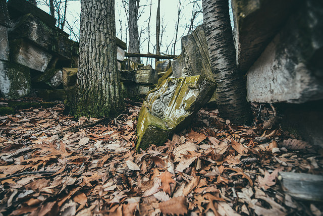
ROCK CREEK: Just ten minutes into Rock Creek Park lies possibly the worst-kept secret in the city: behind a National Park Service maintenance yard lie piles upon piles of stone that used to be part of the U.S. Capitol. The stoneyard is technically off-limits to the public, but it’s not exactly kept under high security; visible from the nearby hiking trail and with no fences surrounding the area, it is fairly easy for someone to simply walk over and bask in the weirdness of being surrounded by chunks of the Capitol (left over from the 1950’s-era renovation). Should you decide to attempt this hike yourself, you can either park as close to the Military Road/Oregon Avenue entrance to the park as possible and walk about 10 minutes to the “super-secret” stoneyard location (hint: it’s visible on Google Earth) or make it into a real hike by starting at the intersection of Shepherd and 18th Streets NW and heading westward and northward up to Friendship Heights. — Rachel Kaufman
Rock Creek Park is accessible from many places in Northwest.
 (Photo by Jorge Bañales)
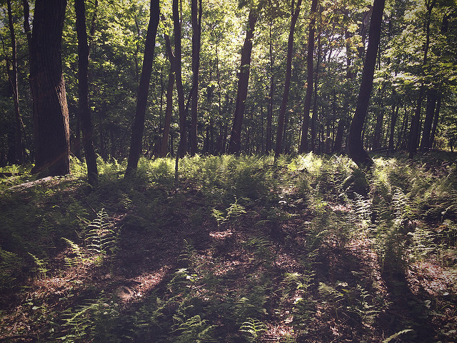
SUGARLOAF MOUNTAIN: Truth be told, this isn’t my favorite mountain around to hike; it is often crowded and the trails are relatively flat. But what it lacks in solitude and challenge, it makes up for in distance (just a 45 minute drive), prettiness, and proximity to a vineyard. — Rachel Sadon
Sugarloaf Mountain is located on the border of Montgomery and Frederick counties, about 40 miles from D.C.
Other ideas: Scott’s Run, Banshee Reeks, Gunpowder Falls, Sky Meadows, Catoctin. Let us know your favorites in the comments.