 Photo by Elvert Barnes.
By DCist contributor Randy Smith
Like so much else, the availability of a Car2Go depends a lot on your location. If you live in Capitol Hill or Petworth, you probably don’t have many moments where you want one of the vehicles, but cannot find one nearby. On the flipside, if you’re a resident in Adams Morgan, Michigan Park, or almost anywhere in Southeast, you’re likely in constant competition for a Car2Go.
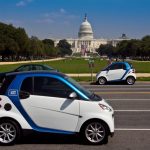
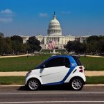
Car2Go is a car sharing company that launched in D.C. in 2012 and expanded to Arlington in 2015. Using an app, drivers can find and reserve nearby cars for use. What makes the service unique is that users don’t need to return their Car2Go car to the spot where their trip began and also, they have the ability to end a journey anywhere within D.C. or Arlington without having to worry about parking costs. Car2Go has about 64,000 subscribers in the region.
Scraping a month of data from the Car2Go API service, we created a map showing average hourly Car2Go availability by neighborhood throughout D.C. and Arlington. With about 800 vehicles in the region, the map illustrates that availability is highly concentrated along key thoroughfares and many of the region’s vital business centers and population hotspots. If you’re in Capitol Hill, you’re likely to always have a car nearby at your time of need with an average hourly availability of 22 cars, plus or minus 6 cars.
However, the majority of the region is not as lucky. Areas such as Congress Heights and Barry Farm in D.C., as well as High View Park and Westover Village in Arlington, consistently have only one car in the neighborhood at any time.
To gain a better understanding of the migration of cars and how availability fluctuates throughout in the day in any given neighborhood, we created a time series map showing a full day in the life of Car2Go vehicles. The map below, showing availability on June 6th, 2017, illustrates the daily commute patterns throughout the region.
Cars begin the day in streetcar suburbs. Around 6 a.m., the cars begin to move. Peak activity happens around 8 a.m., and around 10 a.m., accessible vehicles are at their apex concentration around Foggy Bottom, Penn Quarter, and Chinatown. Activity picks up again by 4 p.m. as cars begin to drift back toward the streetcar suburbs.
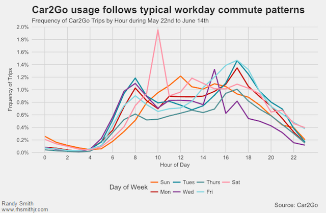
The pattern is reminiscent of the daily commute of many area residents. Looking at hourly frequency of Car2Go trips, activity mirrors archetypical commute patterns during the workweek.
One surprise: the highest frequency of trips occurs at 10 a.m. on Saturdays—peak travel time for brunch.
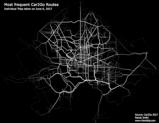
While the time series map illustrates for us where vehicles congregate throughout the day, visualizing individual trips may provide a better insight into how the region utilizes the resource.
The map below, using the same June 6th data, shows every individual trip (about 2,000) that occurred on that day. The brighter a road is, the more trips traveled along that road. More than anything, this really highlights that the usage of Car2Go in Arlington is limited to travel along Route 66, Arlington Blvd, and I395 towards D.C. in addition to limited use along Wilson Blvd and Clarendon Blvd.
About the data: Data was acquired through Car2Go’s API Service. Individual trip routes are approximations and were calculated using Google Maps routing service API. Find all the code for analysis and visuals on my Github.