 Rachel Sadon
D.C. has a sterling reputation for living a car-free life, frequently notching high spots on lists that rank walkability, bikeability, public transit, car-sharing, and, well, living without a car.
But not all parts of the city are created equal for the purposes of ditching one’s personal vehicle.
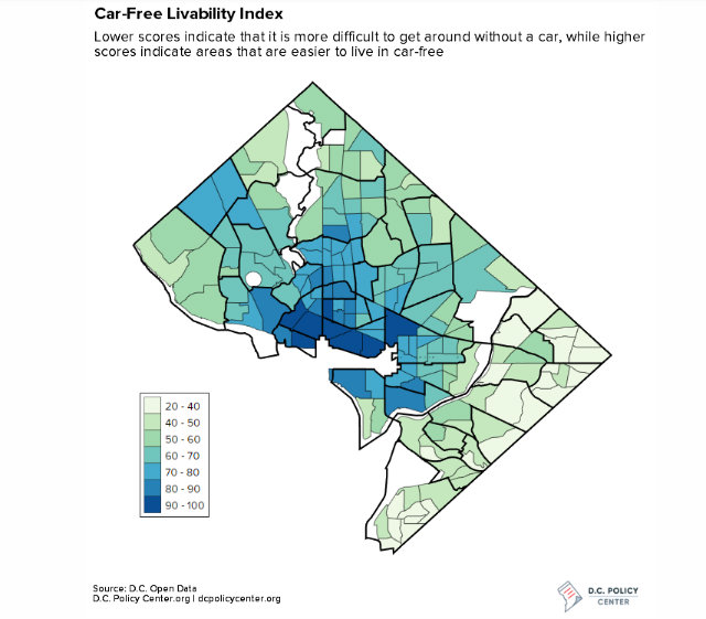
A new analysis from the D.C. Policy Center, created by GIS specialist Randy Smith, shows the D.C. neighborhoods where it is easiest to get by without a car are unsurprisingly clustered around the downtown core. He calculated the ease of living car-free by weighing accessibility of public transit, car2go, cabs, and Capital Bikeshare. In the map below, the dark blue neighborhoods scored the highest.
 (Via the D.C. Policy Center)
Neighborhoods east of the Anacostia River fared the worst for car-free livability, followed by other areas near the District’s borders—with the notable exception of Chevy Chase and Friendship Heights, both wealthy areas along the Red Line.
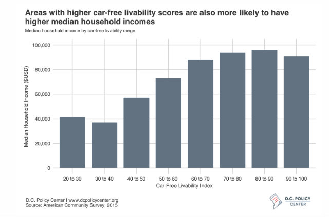
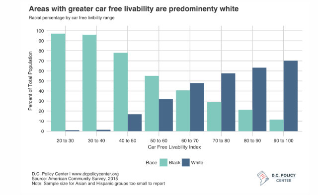
And, in fact, Smith also found a close correlation between high car-free living scores and areas with higher incomes, as well as predominantly white neighborhoods.
 (Via the D.C. Policy Center)
 (Via the D.C. Policy Center)
Ward 2 residents, for example, have a commute time that is six minutes less than the citywide average of 31 minutes, while residents in Wards 7 and 8 are four or five minutes higher and only slightly more likely to drive to work.
And as Smith notes, in those places, “the absence of a car can compound other hardships, potentially lengthening residents’ commutes and reducing access to grocery stores and other amenities … the disparity in scores is manifest during periods of severe weather and interruptions to public transportation, like WMATA’s SafeTrack, for example.”