Natalie Delgadillo
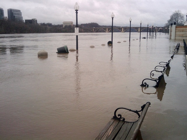
 (
(
Last week, the heavens opened up and a dry July became one of the top 10 wettest on record. Now, we’re edging toward make it all the way up to number one, with another three to five inches possible over the next couple of days.
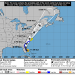
The National Weather Service is predicting the possibility of flash flooding across the D.C. region until 2 a.m. on Wednesday.
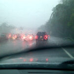
Given the eight inches that already fell on Washington over the weekend, the upcoming downpours, which could total up to five more inches, according to Capital Weather Gang, could overfill rivers, creeks, and soil beds.
NWS predicts that showers and thunderstorms will get more intense Monday afternoon and Monday night, and will keep going all the way through Tuesday night. “Multiple rounds of torrential rainfall” are possible.
These could lead to flash floods across the region, but “urban areas, locations along small streams and creeks, and poor drainage areas” are most vulnerable, NWS says.
After a dry beginning to the month, July has brought a number of torrential storms to the D.C. region. Last week, Metro stations and parkways flooded as commuters were trying to get home from work.