By DCist contributor Mikka Macdonald
Among the 50 largest cities in the country, D.C. ranks third for its access to green spaces and public land. The District has over 600 parks that covers nearly 8,000 acres. Many of the trails can be used for walking, sitting, jogging biking; they’re public lands and they are open for everyone. And there is a heck of a lot of them. So why not visit them?
Sometimes, as Twitter user Meg Bresnahan pointed out, folks just aren’t aware of all the hikes at their fingertips.
Below are just some of the trails and trailheads that residents should know about. Don’t forget to bring water and sun protection with you on the trail. And snacks. Always snacks.
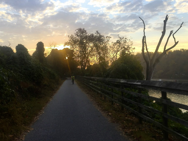
 The Capital Crescent Trail. (Photo by Garner Woodall)
THE CAPITAL CRESCENT TRAIL
What is it? The Capital Crescent Trail is an 11-mile path that stretches from Georgetown up into Bethesda. For the first seven miles, the path is asphalt and the majority of the last four miles (also known as the Georgetown Branch Trail) are gravel. You’ll travel alongside the Potomac, encounter varying degrees of wildlife, and reach access points to Rock Creek Park.
Construction Note: As of last September, a 3.5 miles section between Bethesda and Silver Spring closed while the Purple Line is being constructed. There is a marked on-road detour that you should plan to use until further notice.
Where to find it:
THE GLOVER ARCHBOLD TRAIL
What is it? The Glover Archbold Trail is a 3.1 miles stretch that acts as shortcut between Georgetown and Tenleytown. For folks who don’t want to hike on a more remote trail, the Glover Archbold trail is still a great escape. You can expect a clean path, with some areas where you have to balance on rocks to avoid getting your shoes wet, (depending on the water level), and many good dogs. Due to the size of the wooded area, it is also slightly less crowded than some of its Rock Creek Park counterparts.
Construction Note: Part of the lower section of the trail may be under construction due to a rusting trolley trestle, but there is a road detour available.
Where to find it:
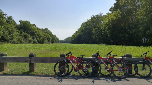 Bikes parked along the C&O Canal. (Photo by Anna Dottle)
THE C&O CANAL TOWPATH
What is it? The Chesapeake & Ohio Canal Towpath is a 184.5 mile long crushed stone path that follows the north bank of Potomac River from Georgetown to Cumberland, Maryland. Although there are brave D.C. residents who travel the entire trail, you certainly don’t have to do that. For those of us looking for a shorter outing, it is a great space for out-and-back trips of any distance. The portion of the trail nearest Georgetown is more developed—and sometimes more comparable to a city street—but if you travel further down, you’ll find more wooded surroundings. Expect heavy traffic of the weekends, few hills, and less wildlife.
Where to find it: The towpath is accessible from multiple sections through Georgetown, there are a few alternative options if you’re willing to go a little further out of town. Please note that The Georgetown Visitor Center entrance (at mile 0.5 of the trail) is currently closed for construction.
THE WESTERN RIDGE TRAIL
What is it? The Western Ridge Trail is a 3.7 mile trail located in Rock Creek Park in Northwest D.C. For most of the trail, you can follow the green blazes along the path that, true to its name, takes you up along some of the ridges of the park. You can expect trail runners and hikers, plus a few uphills that can make your heart rate rise a little more than usual. The National Park Service does not allow bicyclists on its dirt trails.
Want to turn your trail into an 8.8 mile loop? Tack on Valley Trail onto your path, and take your return journey on the more eastern side of Rock Creek park.
Where to find it: The best place to park is at a lot off Beach Drive, right by the border of Maryland and D.C.—the trailhead is right across the street.
This post has been updated to reflect that biking is not permitted on the Western Ridge Trail.