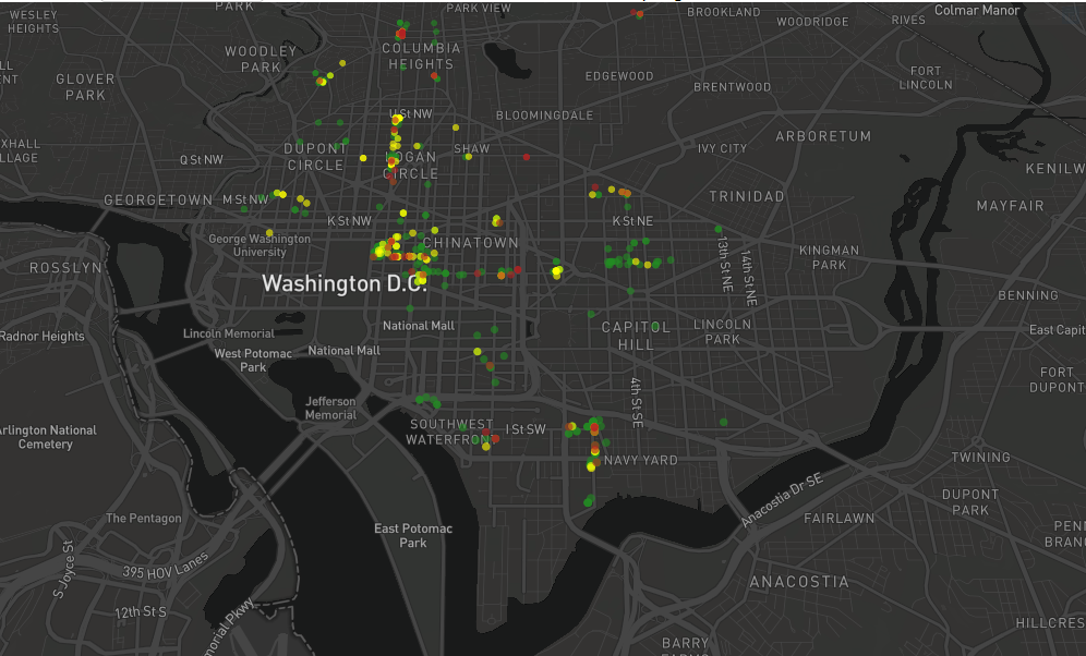
About 70 volunteers fanned out across the District Wednesday during peak commuting windows to log each time a vehicle blocked a bike lane. They didn’t staff every bike lane, but it’s better information than advocates had before.
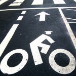
The effort isn’t new, but the tactic is. For years, bicyclists have asked District officials to create safe cycling infrastructure — ideally protected bike lanes. The painted bike lanes common on city streets don’t physically restrict drivers from entering them, often endangering cyclists.
Last year, during bike-to-work week, cycling advocates created “human-protected bike lanes” by linking arms and standing along unprotected lanes. Another tactic: using red plastic cups filled with water to illustrate that cars can easily and quickly run over them, just like painted lines. But that only showed the problem in part of the city. This year, cycling advocates wanted more data.
“We didn’t have a good picture of how many bike lanes are being blocked at a given time,” says Rachel Maisler, one of the project’s organizers.
Now they have the figures to back up their requests for flex posts or concrete barriers. By the end of the day, nearly 700 violations had been logged via a smartphone app. You can see a map of all the violations here.
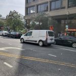
Raanan Barach and Andrew Grinberg spent their lunch hour monitoring the bike lanes near the White House on 14th Street and New York Avenue Northwest. Barach logged 15 vehicles in the bike lane in 40 minutes. On the other side of the street, Grinberg counted 18 in 55 minutes.
At times, there were so many vehicles in the bike lane at one time, they couldn’t keep up.
“I’ve seen the entire bike lane filled at once, with cars [double parking] and cars like fighting other cars waiting for an illegal spot in the bike lane to open up so they can park,” Barach said. “It’s very ridiculous.”
Over the course of an hour, they saw multiple tour buses dispatching tourists to the White House, countless ride-hailing drop-offs and pickups, a paper company dropping off a shipment and an ambulance. Grinberg didn’t have an estimate for how many violations they would eventually tally up.
“I have no idea, but it’s an interesting project,” Grinberg said. ” I mean, all around the city it’s going to look really different, just as far as traffic flows and types of activities.”
Once again: In addition to the obvious solution of protecting the lane, we also need to better manage pick ups and drop offs. In this case it's huge tour buses going to the White House.
— Andrew Grinberg (@AndrewBGrinberg) May 15, 2019
Behind The Idea
Maisler and fellow cyclist Peter Krupa partnered with Mark Sussman and Daniel Schep who created the “How’s My Driving” app for the project. The app allows citizens to take pictures and make note of violations. It can also tell how many outstanding D.C. tickets each car has.
The information collected for the “Data Protected Bike Lane” project doesn’t do much other than raise awareness and create a database to help make their case. (Council member Charles Allen (D-Ward 6) has proposed a pilot project that would deputize 10 people per ward to hand out tickets).
But if the Department of Public Works ticketed every driver that was logged Wednesday, it would have added up to more than $100,000 in tickets. Nearly 30 percent of vehicles documented in the bike lane had outstanding citations and 10 percent racked up so many tickets, the District could legally tow them, according to the data.
Maisler says drivers of vehicles with unpaid citations pose a greater risk to vulnerable road users like pedestrians and bicyclists. She says it shows they don’t care about their actions.
“Imagine if DPW had the capacity to enforce this much,” Maisler pondered. “It’s a legitimate safety issue — people have been killed in other cities because they’ve been forced out of the bike lane and hit by cars.”
At least one spot at 22nd and M St. Northwest wasn’t an issue.
That intersection has protected bike lanes.
https://twitter.com/the_baseband/status/1128654640302764032
This story originally appeared on WAMU.