Jacob Fenston
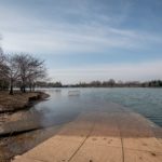
The Tidal Basin, framed by cherry trees and the Washington Monument, is a masterpiece of 19th century engineering, and a marvelous spot to take a selfie or an engagement photo. But it’s also sinking into the Potomac River, and threatened by climate change and neglect.
The Tidal Basin is among the 11 most endangered historic places in 2019, according to a list put out each year by the National Trust for Historic Preservation published Thursday. The list highlights places that are important to the nation’s architectural or cultural history that are at risk of irreparable damage.
The Trust’s Seri Worden notes that the Tidal Basin is located in the nation’s most-visited national park, but says many visitors have no idea it’s in such bad shape.
“The site is so magnificent—especially in the spring with the cherry trees—it’s often easy to overlook the serious infrastructure problems that are occurring at this beloved place.”
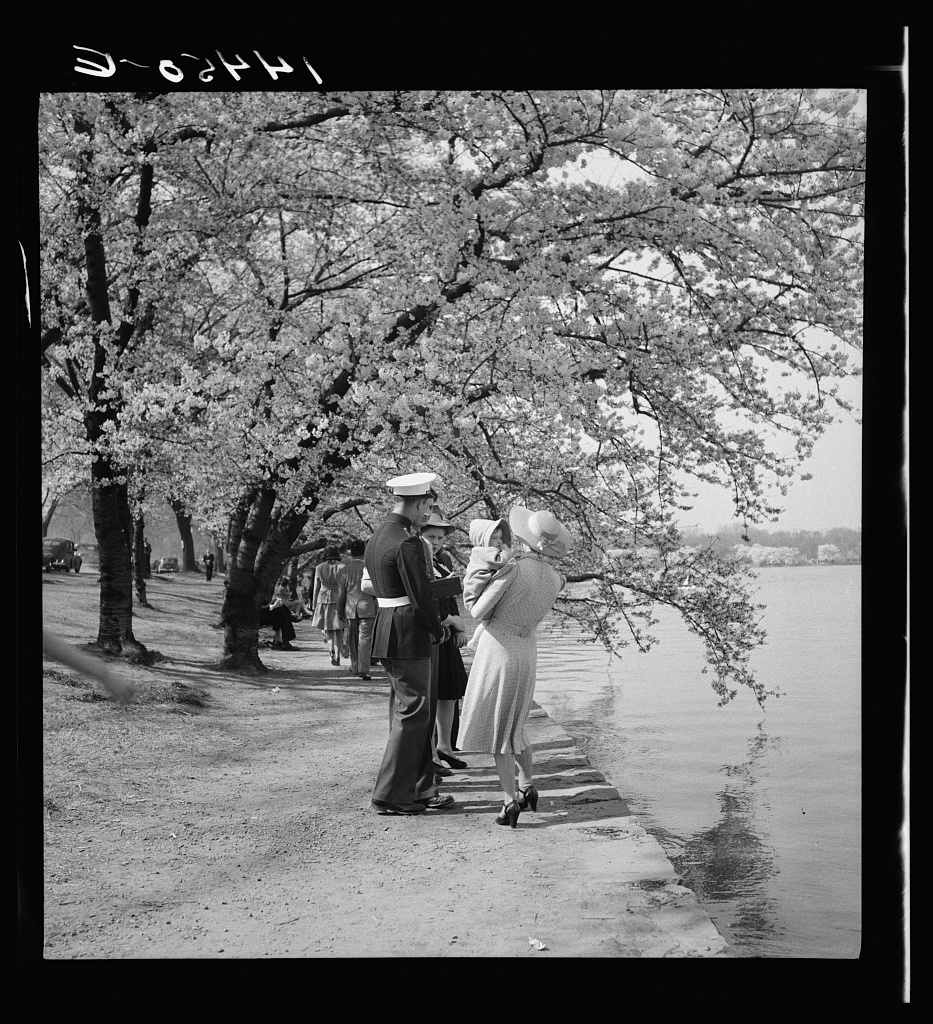
Attendees of the Cherry Blossom Festival in 1941. Infrastructure around the basin looks much the same today.
So what’s wrong with the Tidal Basin? There are three main threats, and they are all intertwined. First: subsidence. Washington, D.C. is sinking—along with much of the land in the region—thanks to long-term geological forces. At the same time, climate change is causing sea levels to rise. The Potomac River has risen 11 inches already over the past 90 years. By 2080, the U.S. Army Corps of Engineers expects the river to rise by as much as another 3.4 feet. Already, the narrow sidewalks around the basin flood on a daily basis.
Thirdly, human neglect of aging infrastructure is threatening the basin. The National Park Service has billions of dollars in deferred maintenance across the park system, and estimates it would cost $500 million to restore the Tidal Basin.

The tidal basin uses tidal forces to flush sediment from Washington Channel.
The basin’s history dates back to the 1880s. The “Potomac Flats” were an expanse of sewage-filled mud and a breeding ground for malaria. Aside from aesthetics, the silty waterfront also caused problems for shipping. The solution, devised by the Army Corps, was to dredge the river and use the fill to build parks. The Tidal Basin’s role was to use the force of the changing tides to flush silt from Washington Channel, to keep it navigable.
Other places on the 11 most endangered list include:
- Ancestral places in Utah, outside the boundaries of Bears Ears National Monument
- Bismarck-Mandan Rail Bridge, a majestic 1883 bridge over the Upper Missouri River in North Dakota, slated to be demolished
- Hacienda Los Torres, a historic coffee hacienda in Puerto Rico.
- Industrial Trust Company Building in Providence, Rhode Island, an Art Deco tower known as the “Superman Building” because of its resemblance to the Daily Planet HQ, and Rhode Island’s tallest building.
- Nashville’s Music Row, threatened by development.
This story originally appeared on WAMU.