 Jordan Pascale
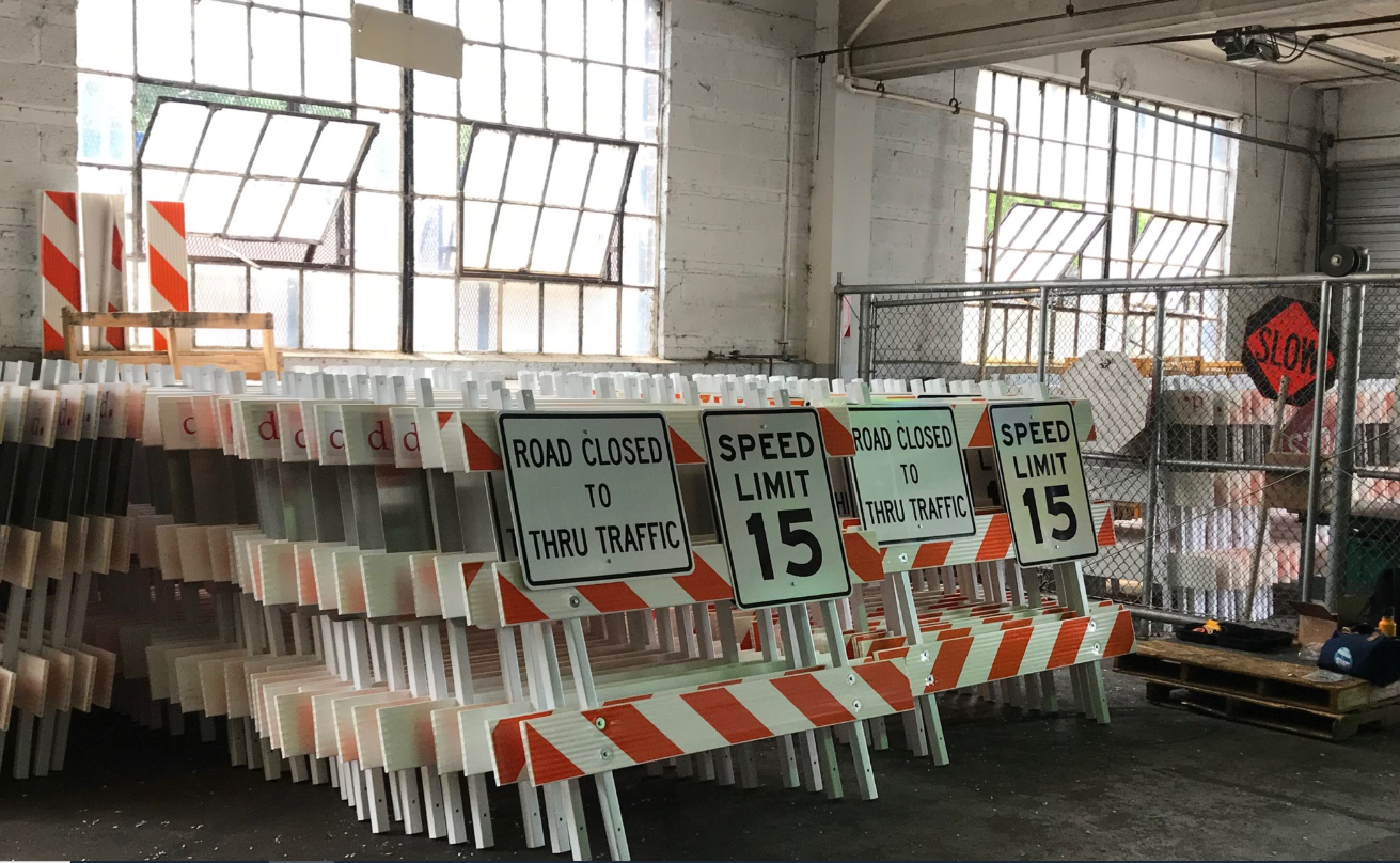
The District is limiting automobile activity on more streets to make them more accommodating to recreation and pedestrians.
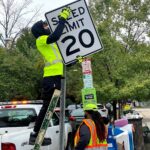
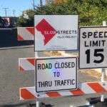
The District Department of Transportation says it will install 17 more miles of “slow streets” by September. The city has made five miles of local roadways into slow streets since June.
In the map below, the red lines are the first wave of slow streets and the blue lines are the additions coming by September.
Slow streets have a 15 mph limit and can be used by local traffic only. Officials say drivers should only go on a slow street if their destination is within two blocks. Residents and essential service vehicles—like emergency vehicles, deliveries and trash collection trucks—can all still use them.
“The approximately 17 miles that we will add over the next several weeks are critical to Mayor Bowser’s vision to reimagine public space during the COVID-19 public health emergency,” DDOT Director Jeff Marootian said in a statement.
The slow street concept gained popularity at the beginning of the coronavirus pandemic while fewer people were driving and more people were out walking and biking. Only local streets, which don’t have a marked centerline or host bus routes, are eligible for the treatment.
The full list of new additions includes:
Ward 1
• 6th Street NW between Lamont Street NW and Keefer Place NW
• Girard Street NW between 14th Street NW and Georgia Avenue NW
• Keefer Place NW between Georgia Avenue and 6th Street NW
• Lamont Street NW between 13th Street NW and Park Place NW
Ward 2
• S Street NW between Massachusetts Avenue and New Jersey Avenue NW (also crosses Wards 1 and 6)
Ward 3
• 39th Street NW between Massachusetts Avenue and Fulton Street NW
• Davenport Street NW between Nebraska Avenue and Linnean Street NW
• Yuma Street NW between Massachusetts Avenue NW and Connecticut Avenue NW
Ward 4
• 8th Street NW between Missouri Avenue and New Hampshire Avenue NW
• Van Buren Street NW between 16th Street NW and North Capitol Street
Ward 5
• 10th Street NE between Otis Street NE and Rhode Island Avenue NE
• 17th Street NE between Randolph Street and Bryant Street/Montana Avenue NE
• K Street NE between Bladensburg Road to 18th Street NE/Maryland Avenue NE
• Oates Street NE between West Virginia Avenue to Bladensburg Road NE
Ward 6
• 3rd Street NE/SE between M Street NE to E Street SE
• E Street SE between 4th Street SE to 11th Street SE/Pennsylvania Avenue SE
• G Street NE between 2nd Street NE and 15h Street NE/Gales Street NE
• Gales Street NE between 15th Street NE and 21st Street NE (crosses Wards 6 and 7)
Ward 7
• B Street SE between Benning Road and 54th Street SE (Ward 6/7)
• Fairlawn Avenue SE between K Street SE and Pennsylvania Avenue SE
• K Street SE between Fairlawn Avenue SE and Randle Circle SE
Ward 8
None. That’s due to a recent amendment from Councilmember Trayon White, who says his ward doesn’t want these type of enhancements. He says it would be a challenge to alter three miles of roads in the ward.
“Many residents in Ward 8 have not supported bike lanes and other measures that appear to force aspects of gentrification and displacement,” White said in his amendment.
Montgomery County has launched similar slow street redesigns, but otherwise, the idea has not been implemented around the rest of the region.
Some residents have criticized DDOT saying 22 miles isn’t nearly enough of a change.