Jacob Fenston
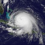
With Hurricane Isabel still churning off the coast of North Carolina, on Sept. 18, 2003, D.C. and federal officials decided to shut down the nation’s capital. Metro trains and buses stopped running mid-morning, the day before the storm hit the city, and 350,000 federal workers were told to stay home.
This was the last time the District saw major storm surge flooding — with the Potomac River cresting in Georgetown at a record 11.3 feet above normal.
As climate change warms the planet, boosting sea levels and supercharging hurricanes, storm surge flooding will only get worse. At the same time, more people are moving into flood-prone areas, and once-industrial areas are turned into bustling neighborhoods along D.C.’s waterfronts.
It’s not just D.C. that’s at risk: an NPR analysis based on modeling from the National Hurricane Center for three critical regions — New York City, D.C., and Miami-Dade County — found that twice as many people could be hit by storm surge flooding by 2080 because of sea level rise. It could impact nearly a quarter million more people.
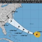
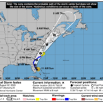
The analysis looked at three historic hurricanes — Sandy, Irma, and Isabel — and projected what the impacts could be if similar storms were to strike in future decades.
How a park-building frenzy a century ago protects D.C.
Isabel blew into the District in the middle of the night, with winds of up to 65 mph, pushing a bulge of water up Potomac and Anacosita Rivers from the Chesapeake Bay, beating the previous storm surge record from 1933. Flooding and downed trees caused an estimated $125 million in damages in D.C., according to the National Weather Service, with millions more in suburban Maryland and Virginia.
But unlike storm surges in other East Coast cities, most of D.C.’s flooding occurred in waterfront parks, including parts of the National Mall.
In coming decades, as the Potomac and Anacostia rivers rise, more areas will be inundated by storm surge flooding. But even in 2080, with sea level several feet higher, waterfront parks would absorb the brunt of flooding from storm surges, leaving most homes and businesses dry.
“D.C. got lucky,” says David Ramos, who teaches graphic design at American University and has studied and mapped Washington’s historic waterways.
Without intending to, early D.C. planners built in a degree of resilience to the waterfront. It started in the late 1870s, when the Army Corps of Engineers began dredging the silted-up Potomac, where Ramos says “a giant, smelly mudflat” had formed near the White House – a consequence of deforestation upstream and a lack of sewage treatment in the city.

The Army Corps built new land with the dredged up muck, creating miles of new shoreline. The White House, which once had an expansive view of the Potomac, was no longer on the waterfront.
D.C. got lucky, Ramos says, because the river dredging project happened to coincide with a federal park-building frenzy – the results of which can be seen in the expansive green spaces of today’s National Mall, Anacostia Park, East Potomac Park and elsewhere.
“Most of the American cities that had big amounts of landfill decided to build housing or businesses on it,” Ramos says.
New York, for example, built office towers and apartments on reclaimed land along the water – places that are now highly vulnerable to storm surge. In fact, when Hurricane Sandy struck in 2012, flooding of reclaimed land in Manhattan took the city’s shoreline back to what it looked like in the 1600s.
But when the District was adding new land in the late 1800s, the city was still relatively young, with lots of agricultural land uphill from the rivers for the city to grow into. And, the new land was created by the government – the Army Corps of Engineers.
“This isn’t landfill created by a private speculator who has to build houses to justify the expense of piling up the dirt,” says Ramos. “This is a disposal site created by the Army Corps. They’re under no obligation to do anything of higher value with it than a park.”
D.C.’s modern waterfront, with stone seawalls, looks nothing like it did before Europeans arrived; when the clear-running rivers were lined with cattails, wild celery, and duckweed. But the parks do provide some of the resilience that the wetlands once did.
“There was no thought at the time about resiliency, withstanding flood damage and things of that sort,” says historian John Wennersten, who has authored several books about D.C.’s waterways. “It was more or less creating more land space for the development of what they called ‘monumental Washington.’ Inadvertently, it offered a modicum of protection against storms and tidal surges.”

A levee system hidden within the landscaping of the National Mall also provides additional protection to low-lying areas downtown. When a hurricane is headed for D.C., National Park Service workers can quickly install a system of 27 aluminum panels, sealing the levee at 17th St. and Constitution Ave. NW, keeping $14 billion of property safe from flooding.
According to the National Hurricane Center model, 2,100 Washingtonians could be directly threatened by an Isabel-like storm in 2080 due to sea level rise, up from 600 people in 2020. But that’s compared to more than 400,000 people who would be impacted in New York City or Miami, according to the NPR analysis.
Development and fiercer storms more people at risk
In today’s Washington, 90% of the waterfront of the Potomac and Anacostia rivers is owned by the federal government. But the few riverfront areas that aren’t parks are among the fastest growing neighborhoods in the city, as developers turn old factories and warehouses into luxury apartments and waterfront restaurants.
“The city is not going to stop building,” says Meredith Upchurch, with the D.C. Department of Energy and Environment. “We still need to be using a lot of those areas for residential housing, for commerce, and people want to be near the river – it’s a very desirable place.”
The city is in the process of updating floodplain regulations to account for rising sea levels. Upchurch says the new regulations will more than double the number of buildings considered flood prone and subject to flood-proofing requirements.

And while D.C. “got lucky” in terms of storm surge flooding compared to other East Coast cities, it’s still at high risk from other types of flooding worsened by climate change.
Flooding can also come from upstream, as heavy rains in the mountains of Virginia, Maryland and West Virginia churn down through the Potomac watershed.
Historian John Wennersten says this type of flooding was a major concern in the early days of the nation’s capital.
“In the 19th century, the city employed a man on horseback in Harpers Ferry to ride immediately to Washington when it seemed like there was going to be a flood coming down the river,” Wennersten says.
The worst floods in recent years, says Upchurch, have been caused by interior flooding, when a storm dumps more rain on the city than storm drains can handle. Unlike storm surges, there is little warning for these storms, and flooding can happen miles from a river.
“The storms are just more frequent, more intense and more unpredictable,” Upchurch says, noting severe interior flooding has occurred in D.C. in 2018, 2019 and 2020.
According to climate modeling conducted by the city, what is now considered a 100-year storm (with a 1-in-100 chance of occurring in any given year) is projected to be a 15-year storm by 2080 – more than six times as likely to occur.
While scientists can model what storm surge flooding will look like in different scenarios, interior flooding is much harder to predict.
Stacey Underwood, with the Army Corps of Engineers, heads up a local flooding task force. She says there is a project in the works to create an integrated flood model that will give city planners a much more detailed idea of which neighborhoods are most at risk – and where drainage systems are inadequate.
“But it costs a lot of money and a lot of time to go out and survey all of those pipes, all those inlets, culverts and so forth, and then build that model.”
In a worst-case scenario, all three types of flooding could happen at the same time – water coming from upstream, downstream, and right overhead. In fact, that’s what officials were preparing for in 2003 – why the entire city shut down ahead of the storm. Forecasters warned of up to 12 inches of rain; after Isabel passed through, less than an inch had fallen on the city.
Methodology
The projections of storm surge used in this story were produced by the Storm Surge Unit at the National Hurricane Center. The researchers provided models of possible storm surge under three different sea level rise scenarios — Intermediate-Low, Intermediate, and Intermediate-High — which are possible depending on how climate change unfolds. For the analysis and maps in this story, NPR used the storm surge models based on the Intermediate sea level rise scenario. The storm surge models have intrinsic uncertainty, and NPR excluded storm surge flooding of less than 1 foot from the maps and analysis because it falls within the likely margin of error. For more information on the sea level rise scenarios, see the National Ocean Service’s 2022 Sea Level Rise Technical Report.
The hypothetical track for Irma is based on a forecasted track from the actual storm in 2019.
To project how many people could be directly threatened by storm surge, NPR used 2020 Census data to analyze how many people live within the projected inundation zone for each time step. The analysis only considered the potential impacts of the flooding within the District of Columbia, and the analysis does not take into account population growth, migration, or mitigation efforts.