All Stories
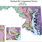
In politics, everyone knows that whichever political party is in power around the time of each decennial census wields huge amounts of power — they get to control the re-drawing of their state’s political map, including congressional districts. The process often produces districts that meander aimlessly across large swaths of land to accommodate certain lawmakers while punish another, and for 2011, there was no bigger offender than Maryland.