Geography is hard, I guess.
Some advice for the geographically challenged governor of South Carolina.

Metro is planning new maps for its bus system that could make navigating around town much easier.

Can you name the Bavarian city located on the Danube that was the legislative seat of the Holy Roman Empire from 1663 to 1806? If not—and don’t blame yourself for not knowing that off the top of your head—then you too would have lost today’s National Geographic Bee.

D.C.’s Matthew Wilson put up a fierce fight, but only managed four right answers of nine questions in preliminary rounds during today’s National Geographic Bee. He may have been fallen to the geography gods, but Maryland’s Adam Rusak didn’t.

As National Geographic Bee Kicks Off, Seventh-Grader Hopes to Bring Home First Championship for D.C.
Starting today, 54 fourth- to eighth-graders from across the country and U.S. territories will battle it out in the National Geographic Bee. Matthew Wilson will be representing D.C. for the second time, hoping to improve on his 2010 performance.

Repeat after us, Home Depot: the University of the District of Columbia is not in Maryland. It’s in D.C. Same goes for Howard.

The District is hungry for revenue. Film and television producers have money. Logically, it only makes sense for the city’s brass to try and court them to film here — which would explain why Mayor Vince Gray is taking some time out of his busy desk work schedule this afternoon to visit the set of Covert Affairs.

Here’s a pretty fantastic video — the result of “years of painstaking work and research” by Dan Bailey, director of the Imaging Research Center (IRC) at the University of Maryland, Baltimore County — which attempts to show what Washington, D.C. looked like 200 years ago.
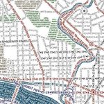
Now, we try not to do too much hawking on this here blog, but, occasionally, like with the District coffee table and the print of D.C. as a Pop Tart, we just can’t help it. That said, check out this map, created by Axis Maps, which “accurately depicts the streets and highways, parks, neighborhoods, coastlines, and physical features of Washington DC using nothing but type” culled from OpenStreetMap.