 Usually in our Revisiting Series, we like to talk about the monuments and memorials you pass on a regular basis; this time, by revisiting the District’s boundary stones, we thought we’d point out something you might never have even seen.
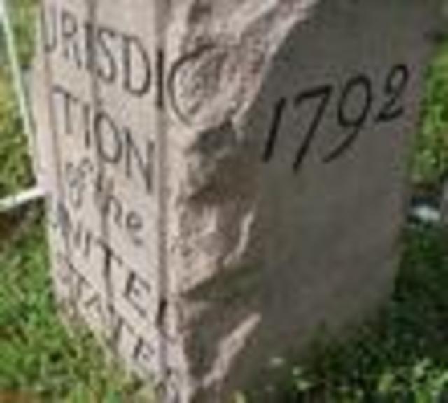
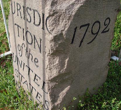
In fairness, they’re easy to miss. Of the 40 original stones, two have been lost, and the rest have been marred and eroded from sitting outside for 216 years. Some sit in no trespassing zones, some serve as target practice, and others have been decapitated by farm plows or bulldozers. Most, though, rest in front yards, woods, intersections, or parking lots, unnoticed and under appreciated.
Mark Kennedy, who runs Boundarystones.org, explained that although D.C. was not officially the capital until 1800, the first stone was laid on April 15, 1791, by a surveying crew led by Major Andrew Ellicott on a project assigned by George Washington himself. Ellicott put a stone at each mile of the “Ten Miles Square,” as D.C. was nicknamed. Starting at Jones’ Point in the south, the stones went to Falls Church (in Andrew Ellicott Park) in the West, Woodside in the North, and Bennings in the East.
Unfortunately, in 1847 the U.S. ceded land west of the Potomac back to Virginia, cutting the District by a third, and a good number of the stones were excluded from serving their original purpose. The stones became, in essence, little more than memory markers.
And yet, as we’ve seen from revisiting the Old Stone House in Georgetown, sometimes memory markers are also enjoyable time machines. At the very least, there seems to be something irresistible about these kinds of historical indicators, about the perspective their journeys through time can provide.