 Photo courtesy DCRA.
This morning, we got word from the Department of Consumer and Regulatory Affairs that they would soon be uploading a bunch of neat findings from the District’s Office of the Surveyor. According to DCRA, the Surveyor has “more than a century” worth of maps, some of which the agency plans on uploading to the agency’s Flickr feed over the coming weeks and months.
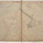
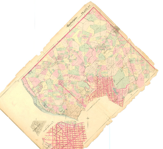
The example above is a hand-colored map from 1887 which depicts the boundaries of neighborhoods in D.C. at the time. You can see some of the cool details from far away — for example, the red lines which represent the major roads at the time — but DCRA recommends that you check out the highest resolution possible to really get a good idea of the kind of awesome detail and history these maps get into and reveal.
We’ve taken the liberty of taking a clip of the high-res version after the jump so you can see what we’re talking about — when D.C. had its own version of “Harlem,” located between what is now Georgetown University and Georgetown Reservoir.