
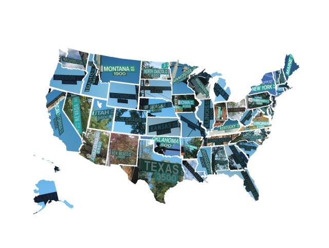
 Photo collage by Julia Lovett.
Here’s something awesome we just had to share: Julia Lovett, a student at Georgetown University, took a ride around the District on her bicycle last fall with the intention to capture a photograph of every state-named roadway in the District proper. She then took the time to mold those images into a map of the U.S., placing each street sign into the appropriate state. (And yes, we know that it’s missing Puerto Rico Avenue NE — but then again, Puerto Rico isn’t a state, so we’re willing to cut Julia a break.) You can see a blown up version of the map by clicking on the map above or here.
Lovett says that she has “intentions to do prints at some point,” and says if people are interested, they should send her an email.

