The Census Bureau released yesterday its Census Explorer, “a new interactive map that gives users easier access to neighborhood-level statistics.”
 Using statistics from the 2008 to 2012 American Community Survey, as well as the 2000 and 2010 Census, the tool can visualize data on total population, home ownership, education level and more.
For example, here’s the percentage of owner occupied housing in D.C., based on the ACS.
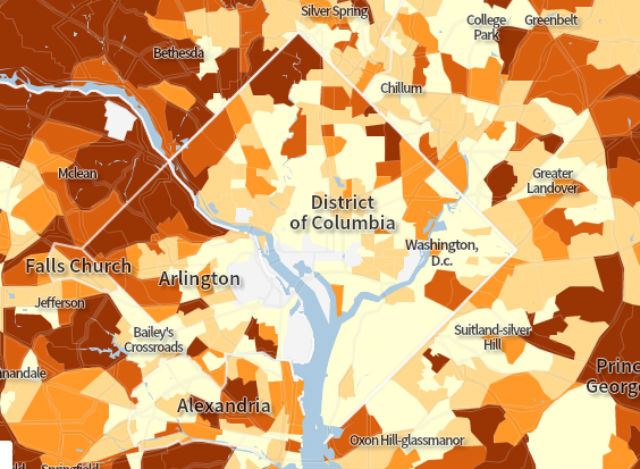 Via Census Bureau.
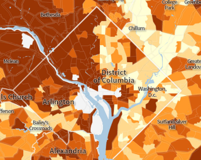
 And here’s a map that shows the percentage of the over 25 population that has at least a high school diploma.
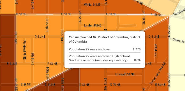
You can zoom in on individual areas. This is high school degree data for a small section of the Atlas District.
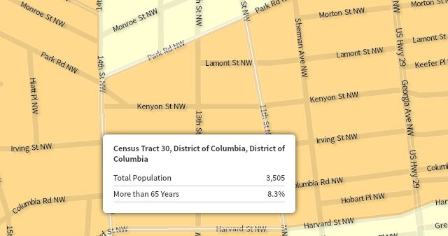
And here’s a map showing the percentage of the population 65 and older in the part of Columbia Heights near the 11th Street restaurant strip. 
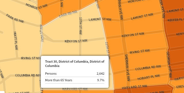
Here’s that same area, based on data from the 1990 Census.
Obviously, lots to explore. Check out the tool here.