And on the fourth day of the week, the rains stopped and the sun decided to make an appearance. It’s good they did, as flooding has impacted areas of our region, leading to water rescues and evacuations.
How else can we measure the impact of the 4.18 inches of rain D.C. (or, rather, National Airport) saw since Monday?
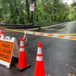
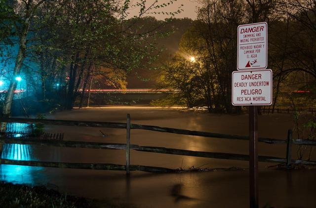
Above are photos from our own Pablo Maurer taken near Pierce Mill in Rock Creek Park, located at Tilden Street and Beach Drive. The National Park Service says “portions of Beach Drive are currently closed due to mud and debris, so drivers and cyclists are advised to plan alternate routes.”
Portions of the Rock Creek Park trail system are also currently closed to pedestrians and cyclists due to damage and debris.
Drivers, commuters and residents are reminded to obey barricades and posted closures as they are in place for public safety. In areas that are open to the public, visitors should still use caution due to swift moving water and other potential hazards. Additional road, trail and facility closures may be required to protect public health and safety, and could remain in effect through the weekend.
Or take a look at these charts, via the National Weather Service, that show moderate flooding at the Washington Channel and the Potomac River at Georgetown.
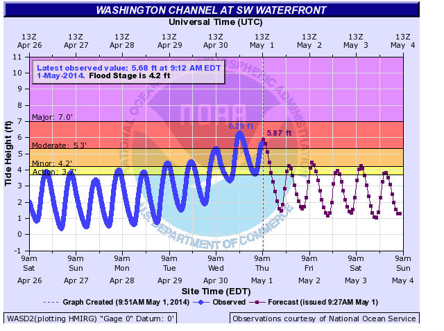 Via NWS.
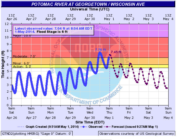 Via NWS.
And here’s how your day may be impacted by the rain.
Due to large amount of rain this week, grass fields are closed. Synthetic are open. Keep the fields weather hotline # handy, (202) 671-0331
— DCParksAndRecreation (@DCDPR) May 1, 2014
Capital Crescent Trail closed due to sewage spill from Fletcher’s Cove to Water St until the weekend. Use C&O Canal Trail instead. #bikedc
— WABA (@WABADC) May 1, 2014