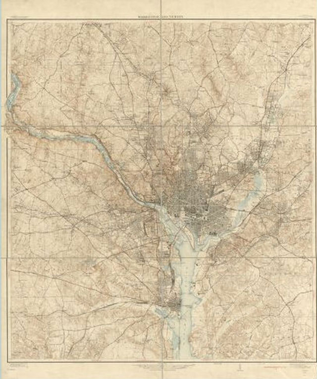
 Map of D.C. from 1929. Via Library of Congress.
At the moment, about 8,000 historical maps of D.C. are sitting in drawers on the third floor at the Martin Luther King Jr., Memorial Library. Now D.C. Public Library staff members are collaborating with the non-profit education project, MapStory, to digitize some of these documents for easy public use.
The maps are part of the Washingtoniana Collection, range in date from 1612 to the present and are found both in print and microfiche. Lauren Martino, a special collections librarian working on the project, says about 100 to 200 will be selected for scanning. It’s been “really challenging to pick,” she said, but they’re focusing on print real estate directories that date back to 1887. Martino said they were selected as the maps are “really descriptive and really colorful.” Residents can use these maps to see the outline of their homes, and for that reason, Martino said they’re very popular.
“People are going to be able to use our maps in a new way and do something creative with them, and actually tell a story with them,” she said.
The maps will be hosted on DCPL’s site, as well as MapStory, where they can be layered and combined with other data for storytelling purposes. As an added bonus, the maps will have a digital record. At the moment, they can only be found via card catalog.
Martino said the maps are “almost like a secret in here. There’s information on the website, but there really hasn’t been a good way to look at what we have.”
Indeed, once the maps are digitized — they have to be sent off-site for scanning, which will take a few weeks — DCPL will hold programming around them. This includes “warp-a-thons” where members of the public can help rectify the maps. MapStory uses a tool called a “warper” to plot an old map on top of a digital map, as Jon Marino, director of content for the non-profit, explained. Programs around storytelling with the maps will follow.
Martino said this will open the maps to “more interaction with the public,” rather than just having them available to people who have time to visit MLK.
While one goal of the project is to make these maps easily available to the public, Martino said DCPL also wants to “set a model that other libraries can use to work with non-profit groups.”
MapStory’s Marino said a pilot like this and the tutorial materials it produces “can inform and help libraries nationwide think about how they can use historical spatial data used in their collections.”