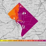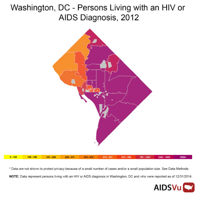
By the end of 2012, 16,072 people were living with HIV or AIDS in the District of Columbia. While the number of newly diagnosed cases has been steadily decreasing in D.C., nearly 2.5 percent of D.C. population is HIV positive, which, according to the World Health Organizations 1 percent definition, qualifies as an epidemic.
In honor of National HIV Testing Week, AIDSVu—part of the Rollins School of Public Health at Emory University in partnership with Gilead Sciences—created an updated interactive map breaking down the geographic impact of HIV/AIDS in D.C.
The map is broken down three ways—by Ward, by zip code, and by census tract—to show where HIV/AIDS patients are residing throughout the city, culled from data collected in 2011. The map also breaks down the data for HIV/AIDS patients by race, age, sex, and social determinants of health.
Broken down by Ward, every part of the city, save for Ward 3, has more 1,051 HIV/AIDS patients. Even when the data is broken down by zip code, the map shows that a majority of HIV/AIDS patients are generally spread out throughout the city. You can see the full interactive map here.