Rachel Kurzius
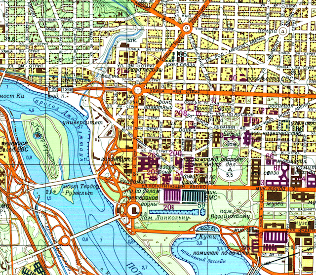 Image courtesy of
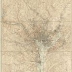
What did Washington D.C. look like to the Soviets? A set of detailed maps from the Cold War era, replete with Cyrillic writing on familiar landmarks, gives one perspective.
Elliot Carter, who runs the Architect of the Capital blog, calls the maps “a total goldmine.” He got them from John Davies, a British-based researcher and programmer who has been collecting and investigating the Soviet maps for more than a decade.
The maps of the District are just a taste of a much larger mapmaking program that spanned the globe. The USSR wasn’t the only country to focus on cartography during the Cold War, but their maps were ultimately more exhaustive because the Soviets’ military might was in their tanks—meaning they needed more details about considerations like road measurements—according to this excellent read about the maps from Wired.
“The Soviet mindset comes through in the way they present the information,” Carter, a history buff, says. “They’re obsessed with industry. We wouldn’t consider D.C. an industrial center, but they have really specific information about manufacturing and about Georgetown, which they were under the impression was still an active port.”
As Carter points out, though, the D.C. maps go beyond what might be necessary for a military invasion. They show foot trails at Arlington National Cemetery, for instance.
Davies believes that the minutiae on the maps points to a larger purpose than mere military. “If it’s an invasion map, you wouldn’t show the bus stations,” Davies told Wired. “It’s a map for when you’re in charge.”
Carter posted the maps to the D.C. subreddit after receiving a “deluge of comments asking for them,” he says. Some commenters suggest printing them out as conversation-starting artwork.
He spends his days as a communications specialist in Dupont, and launched Architect of the Capital (not to be confused with the Architect of the Capitol, which maintains the Capitol complex) about three months ago as a “night and weekend project of passion.” He has already uncovered an abandoned tunnel between the Library of Congress and the Capitol Building built solely for the purpose of transporting books on a conveyor belt.
How’d he figure out the tunnel existed? He was at the “Library of Congress, looking at old blueprints. It was on old blueprints and then they just stopped marking it,” he says.
Carter keeps a running list on his phone of details regarding D.C.’s hidden history, like obscure memorials, for future Architect of the Capital posts. “I read a lot of plaques,” he says.
Here are the Soviet maps of D.C., courtesy of Elliot Carter and John Davies (click for more detail).