Jacob Fenston
DCist is providing special coverage to climate issues this week as part of Covering Climate Now, a global collaboration of 250 news outlets designed to strengthen coverage of the climate story. Many of these stories originated as questions from our readers.
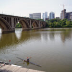
Since humans began burning fossil fuels, the Earth’s temperature has gone up about 1.8 degrees Fahrenheit. In the years since the city of Alexandria, Virginia, was founded in 1749, sea level on the Potomac River has risen roughly one foot.
Nowadays, hundreds of times a year, high tide on the Potomac pushes water into the streets along Alexandria’s waterfront.
“Everyone down here is very casual when it comes to flooding,” says Trae Lamond, who owns the restaurant Chadwicks, less than a block from the river. “There’ll be a foot and a half of water, cars will be parked in it, half way up their door. People walk by it like it’s no big deal.”
Last September—the rainiest on record—the street outside flooded 30 times in one month. Regular customers had no problem getting to Chadwicks, going around the back, but Lamond says tourists saw the closed street and turned away.
“The previous September, we did tens of thousands of dollars in sales more,” says Lamond.
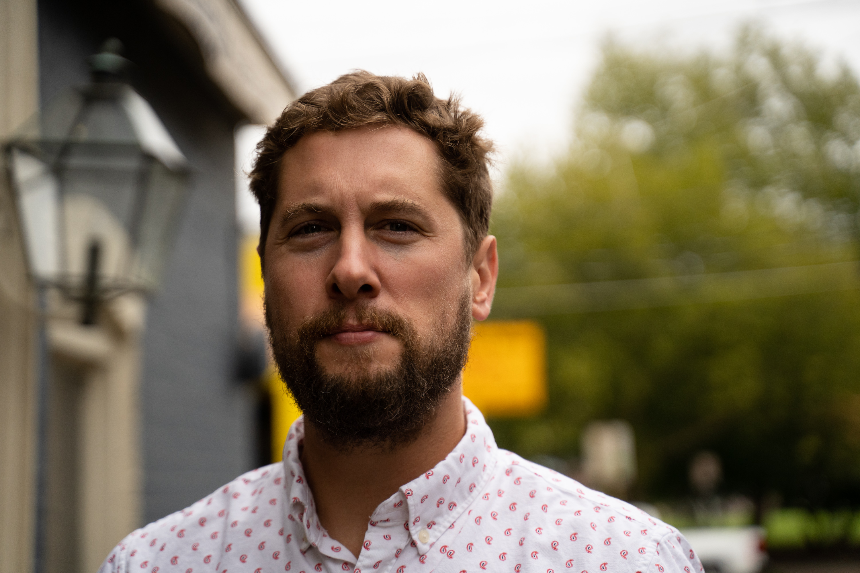
Trae Lamond, owner of Chadwicks. The restaurant has yet to flood since he started there in 2004, but there have been numerous close calls.
This is what’s called nuisance flooding—it’s annoying, but doesn’t cause any physical damage. It’s been going on for years in Old Town Alexandria, affecting a narrow strip of businesses and parks along the waterfront about 1.5 miles long. In addition to nuisance flooding, a higher sea level means more severe flooding during a big storm. In 2003, Hurricane Isabel brought four feet of water into Chadwicks.
“They had to gut the whole first floor,” says Lamond, who started working at the restaurant a year later.
Increased flooding is just one of the ways climate change is affecting the D.C. region. A few years ago, District government hired a group of climate scientists to create downscaled climate models specific to the D.C. region.
Kate Johnson, climate chief with the District Department of Energy and Environment, says this research shows D.C. is going to be “warmer, it’s going to be wetter, and it’s going to be wilder in terms of our weather.”
Let’s break down one ‘W’ at a time:
Wetter: You Really Will Need A Duck Boat To See The National Mall
Sea level is rising twice as fast here as the global average. Even though D.C. isn’t on the ocean, both the Potomac and Anacostia rivers are influenced by the ocean’s tides and sea level. Relative sea level on the two rivers—and throughout the Chesapeake Bay region—is rising more quickly than elsewhere, because at the same time the water is rising (from melting glaciers and expanding oceans), the land here is sinking. This is due to a geologic phenomenon called subsidence.
Some 20,000 years ago, what’s now Canada and the northern U.S. were covered by a gigantic mass of ice—the Laurentide Ice Sheet. Over the millenia, this ice pressed down on the land it covered, but around the edges, it pushed the land up. Imagine lying down on a mattress: around the imprint of your body, the edges of the bed are levered up a bit. In geology, this is called a peripheral forebulge—now that the ice is gone, that bulge (the land in the Mid-Atlantic) is sinking back.
As for how much sea level will rise in the future, this is one of the more tricky questions in climate science. It depends not only on how much carbon humans continue to emit, but also the rate at which ice sheets destabilize and melt.
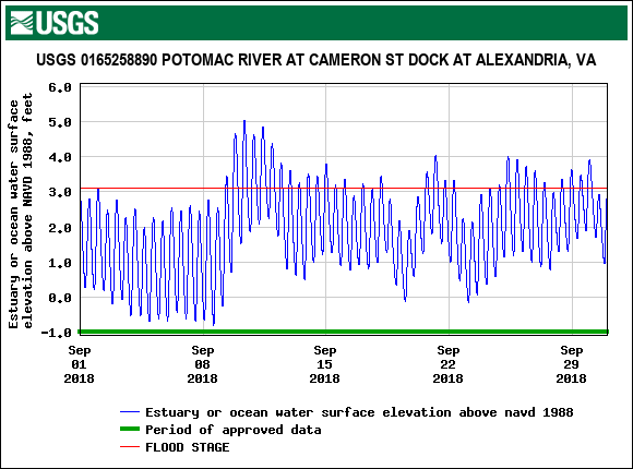
The 30 times high tides flooded streets in Old Town Alexandria last September.
The latest research, according to the federal government’s most recent National Climate Assessment, shows worst-case sea level rise in Washington could raise the rivers 11 feet by 2100. That would put Reagan National Airport under water, along with much of the National Mall, East Potomac Park and Anacostia Park. Federal buildings downtown would be below sea level, as would neighborhoods in Alexandria. Joint Base Anacostia-Bolling would be inundated, and so would the Navy Yard.
While this scenario is physically possible, according to the National Climate Assessment, “the probability of such an extreme outcome cannot currently be assessed.”
Kate Johnson says District planners consider a rise of six feet as a more likely upper limit within this century. However, sea levels will continue to rise well after 2100—even if the world stops burning fossil fuels. At the current 1.8 degrees of warming, we can expect an eventual 20 feet of sea level rise.
Wilder: Who Could Forget The Derecho?
By the year 2050, what was once considered a 100 year storm could be a 25 year storm. By the year 2080, that same storm (producing 8 inches of rain), could be a 15-year storm. These are the storms that engorge our rivers and overwhelm our storm drains, leading to flooding in neighborhoods far from waterways.
Johnson says there will be more of all sorts of wilder weather, fueled by warmer air and more water in the atmosphere. “Coastal storms like hurricanes and nor’easters, or a lot of D.C. residents will remember the derecho from a few years ago, or just more severe thunderstorms that can do things like knock out power.”
In 2006, a storm on June 25 produced seven inches of rain, flooding many federal buildings downtown, causing millions of dollars of damage. The IRS headquarters, Commerce Department, Justice Department and National Archives all sustained damage and were forced to close. At the IRS, the basement housing the agency’s electrical equipment was inundated with 20 feet of water. More recently, on July 8, 2019, a Monday morning storm dumped a month’s-worth of rain in one hour.
Warmer: Two Or Three Times As Many Days That ‘Feel Like’ 95 Degrees
By 2080, there could be two or three times as many “heat emergency” days—when heat and humidity makes it feel like 95 degrees.
“So, going from about 20 days today, to really an entire summer that starts to look like a heat emergency,” says Johnson.
The average summer temperature will rise as well—from 87 degrees historically, to between 92 and 97 degrees by the 2080s. Warmer winters aren’t good either—allowing, for example, the spread of the mosquito species that transmit tropical diseases.
A recent study found that D.C.’s climate will feel like Mississippi by the end of the century, if carbon emissions are not drastically cut.
‘We’re Not Even Rearranging The Deck Chairs’
All of these local impacts of climate change won’t occur in a vacuum, but rather in the context of a destabilized world. One commonly cited study found climate change could create 200 million climate refugees—people seeking refuge from areas wrecked by disasters brought on by global warming—by the year 2050.
The global economy will take a hit. Consider, as just an example, coastal property. “By 2045, well within the lifetime of a mortgage issued today, we have about $118 billion worth of homes at risk from chronic high tide flooding,” says Rachel Cleetus, with the Union of Concerned Scientists. She co-authored a study that found more than 300,000 homes will be—literally—underwater in the continental United States before midcentury, including 14,000 homes in Maryland and 9,000 in Virginia.
“Climate change isn’t happening somewhere else, it is physically happening here,” says Danielle Meitiv, a climate scientist and activist who lives in Montgomery County. “But even when it does happen somewhere else, it affects us.”
D.C. and other governments in the region have plans to adapt to climate change—and to reduce emissions to do our part to slow down global warming. D.C. has a law requiring 100 percent renewable energy by 2032. Montgomery County has set a goal to cut carbon emissions by 80 percent county-wide by 2027, but has made little progress so far. But despite these initiatives, Meitiv says it’s not nearly enough to address climate change.
“The whole Titanic analogy: We’re not even rearranging the deck chairs. We’re counting them or something,” she says.
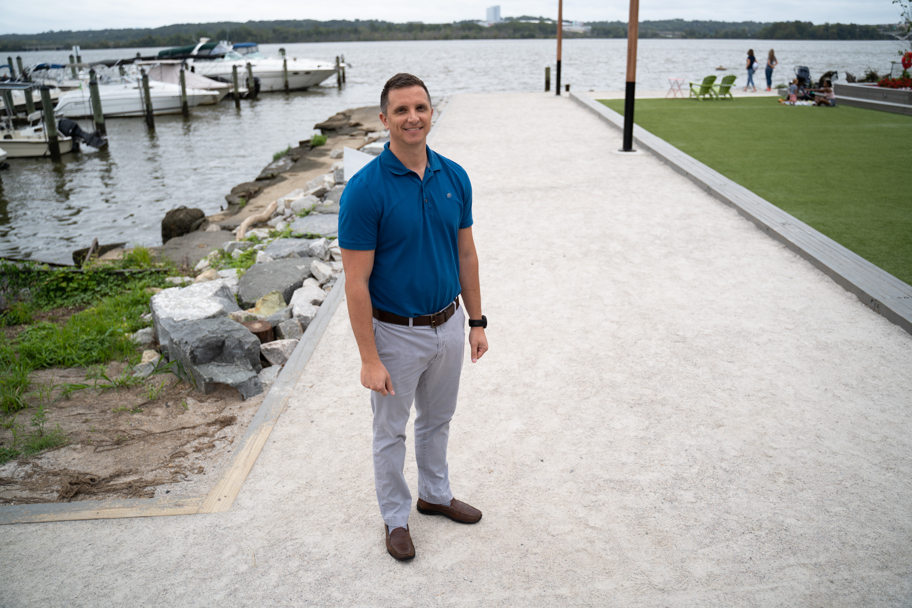
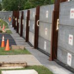
Tony Gammon, in a new waterfront park. The gravel path will be raised two to three feet to prevent flooding.
In Alexandria, the city is planning a project to address the flooding along the waterfront. It’s a new seawall that will raise the shoreline 2 to 3 feet above where it is now. But this is only enough to protect against today’s 10-year storm, and it doesn’t account for a rising Potomac.
“At the time a lot of the study was done—it’s been several years—it wasn’t a topic on the forefront,” says Tony Gammon, deputy director of the city’s Department of Project Implementation.
More on the forefront, during the planning process, was aesthetics—would the seawall block the river view? Gammon says planners are now looking at ways the barrier could be added onto in the coming decades.
“We’re looking at, in our design process, ways to future-proof that. There could be changes that are added on, 10, 20, 30 years in the future,” he says.
Restaurant owner Trae Lamond says he’s looking forward to relief from regular flooding.
“I just hope we keep up with climate change and we don’t set ourselves up for looking like a bunch of yokels because we fixed a decades-old problem and didn’t plan for the future.”
This story originally appeared on WAMU.