On an especially chaotic night, the U.S. Army flew one of its helicopters so low that trash, signs, and branches whipped around people protesting George Floyd’s killing in Chinatown. It was a scare tactic that the military uses in combat zones, and it worked: Protesters dispersed, and scattered around downtown blocks, until they eventually reconvened in a group on E Street NW.
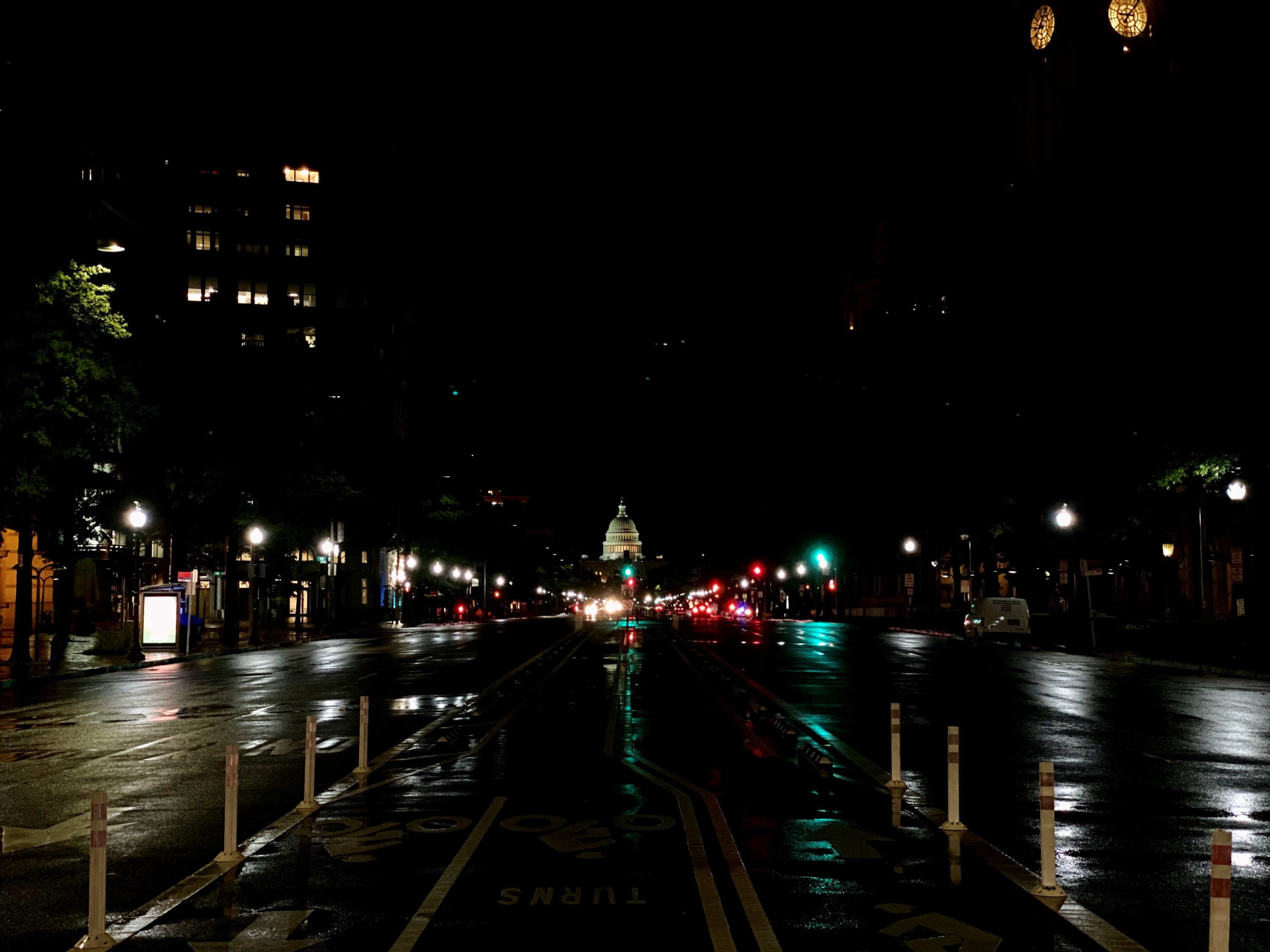
Leaderless, they started marching down the road, and most of them didn’t know where they were headed. But that changed when they reached New Jersey Avenue NW, and the view of the lit-up Capitol dome gave the marchers somewhere to go to protest their government.
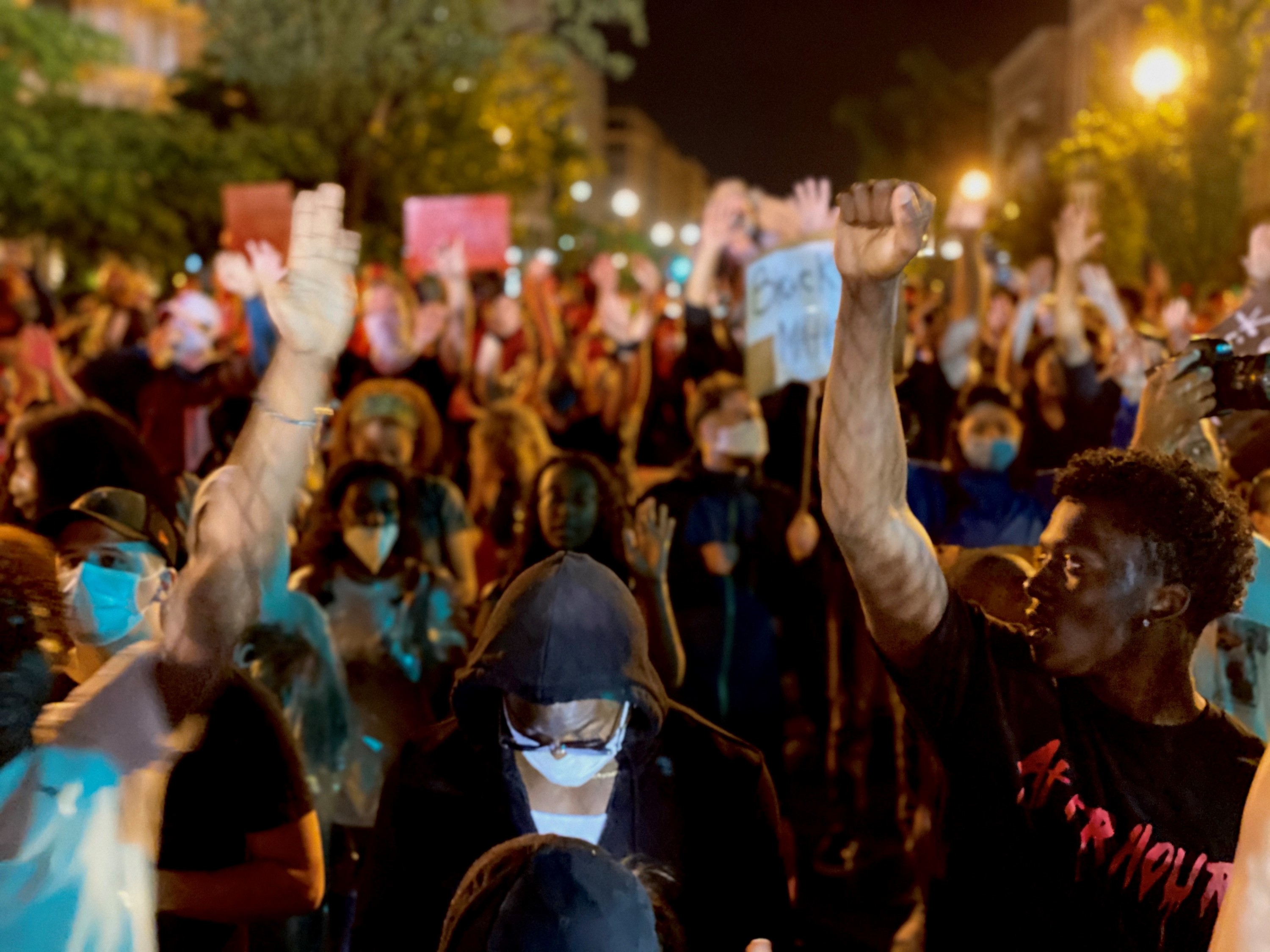
While covering these demonstrations every night, I’ve noticed a pattern: Every time law enforcement tried to disorient or disperse crowds, the thousands of protesters were able to reconnect and organize marches on the spot — finding their way to the White House or Capitol with ease. And that’s not a coincidence; it’s in part because of Washington, D.C.’s street grid, in some ways a monument to democracy and republicanism, was designed for just that.
Washington’s core was laid out by Pierre L’Enfant, a French-American engineer and city planner, when the federal government decided it needed a new capitol. George Washington carved out 10 miles square on the Potomac River, and appointed L’Enfant in 1791 to plan an ambitious new seat of government.
But L’Enfant didn’t exactly carry out his vision alone: He was dismissed from the job in 1792—and he reportedly took his layout with him. That’s when Benjamin Banneker, a free black man who had surveyed the capital and helped establish its boundary points, stepped in. Banneker is said to have redrawn L’Enfant’s plans from memory in two days, though whether actually he did has been debated by historians; his history and legacy have yet to be fully excavated.
L’Enfant was obsessed with symbolism, and he wanted to create a city that reflected the federalist system in the United States. It’s why the city’s four quadrants intersect right at the center of the Capitol — or the “People’s House” — which houses the most directly democratic arm of the federal government.
“The number one icon of democracy is the Capitol building, the elected legislature,” said Scott W. Berg, author of the book Grand Avenues: The Story of Pierre Charles L’Enfant, the French Visionary Who Designed Washington, D.C. “So the placement of that in the plan, where the largest avenues converge, suggests this is the most important place.”
That’s in stark contrast to the European cities D.C. was inspired by, which were not democratic when they were built, and tended to celebrate a monarch. Take Versailles, which is considered one of D.C.’s ancestors.
“The entire plan of Versailles has all the lines and diagonals center on the king’s bedroom — literally the space where he’s supposed to be creating the next king — whereas all the streets in D.C. center on the Capitol building, the representative body of the people,” Berg says.
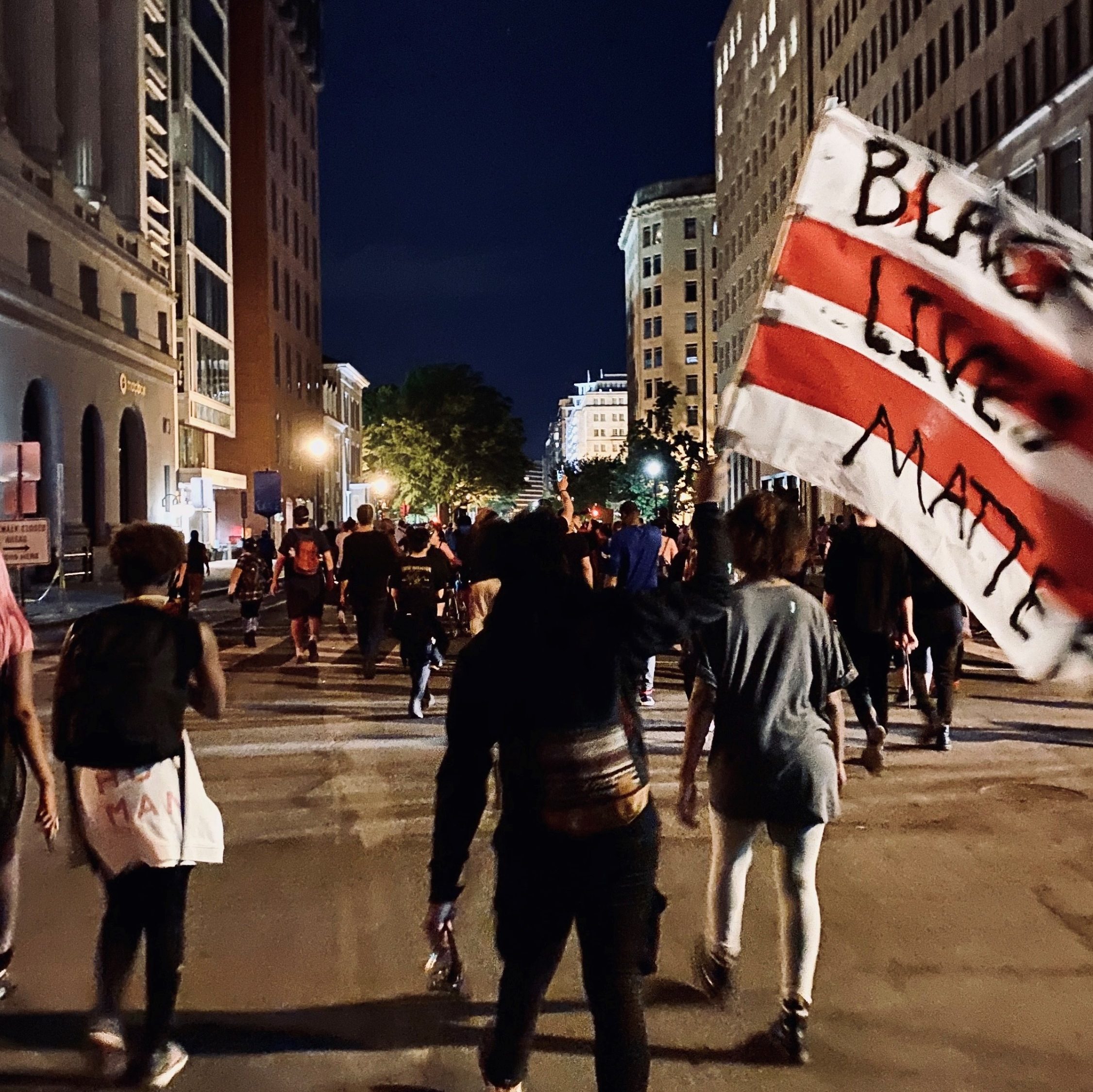
And it’s not just the Capitol that grabs the city’s attention. Other important government buildings, like the White House, also lie at the intersection of several avenues. As a result, major boulevards have sweeping vistas of the centers of American government, which in today’s D.C. is allowing protesters to easily navigate where to go — almost effortlessly — to express their discontent.
On Tuesday, for example, protesters were able to march from Lafayette Square to U Street NW to the Capitol and back up to the White House without a leader in the front to help them navigate. And on almost every day so far, they’ve made the trek from the White House to the Capitol and back on Pennsylvania Avenue NW at least once. Because of the street plan, these government buildings have become an almost natural place for demonstrators to gravitate toward.
There has long been a myth that the city’s diagonal avenues were built to accommodate a swift military defense in the event of an invasion. But the truth is that they were built to provide nice views that allow people to better orient themselves.
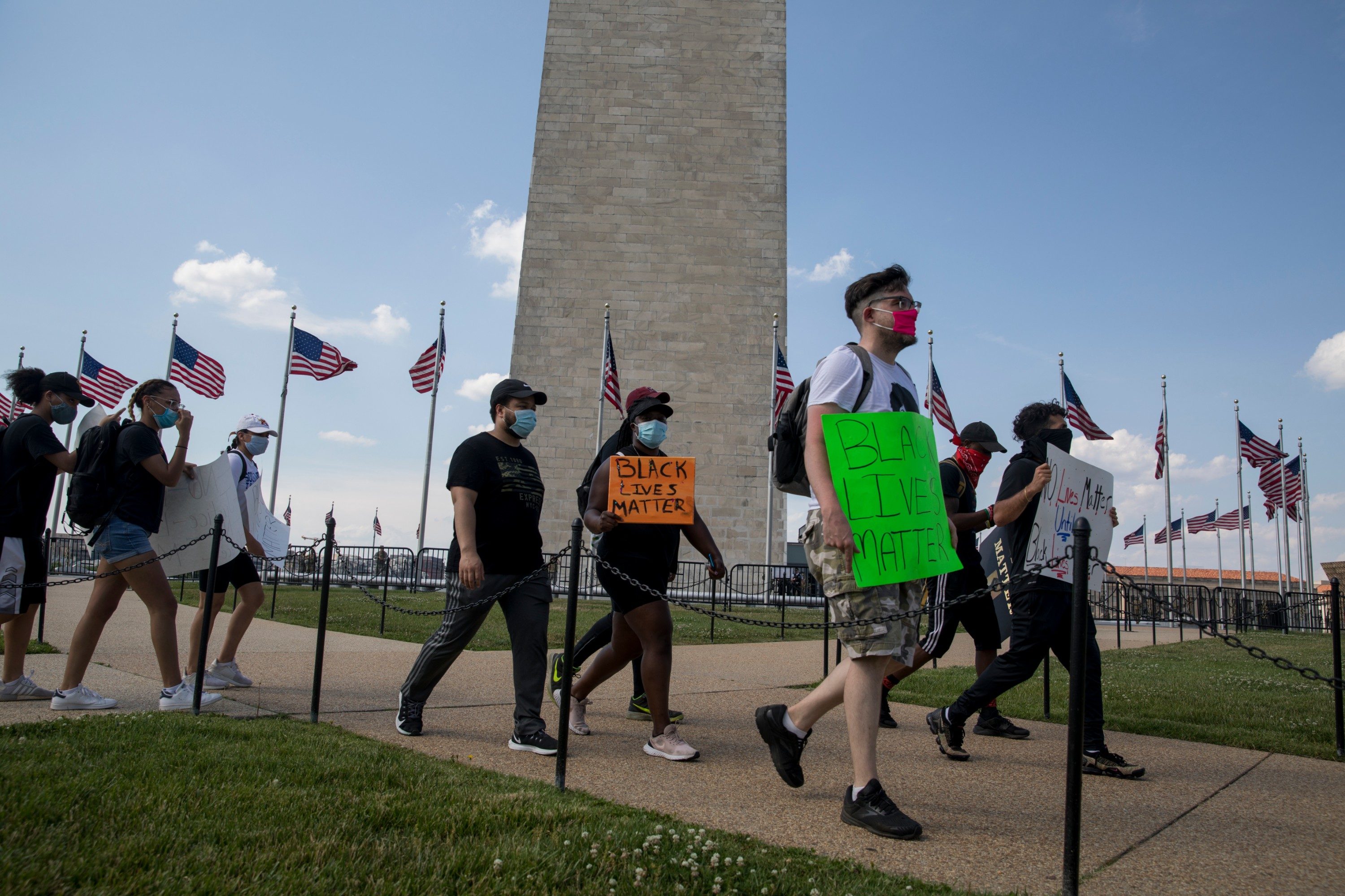
Like the streets, parks too were built for civic engagement. The National Mall, for example, has served as a place for Americans from across the country to air their grievances to those who are governing them.
It was originally designed to be America’s Main Street, Berg said — a gathering spot for the public, where people could walk and be civically engaged by going to places of learning (like today’s Smithsonian museums) and government buildings.
But because of its proximity to the government, it eventually picked up another reason for people to go: Protests. From Martin Luther King, Jr.’s “I Have a Dream” speech to the National March for Lesbian and Gay Rights to the Million Man March to the Women’s March, Americans of all backgrounds have inherently understood that the Mall is a place to go to have their voices heard. (It also happens to be where presidents address the nation in their inaugural address.) “It’s a natural evolution of L’Enfant’s idea of a national gathering place.”
While these uses for the city’s streets were not explicitly made, their effectiveness in serving democratic ideals is undeniable.
“L’Enfant viewed the city as a stage set, as a place where people would act out the process of democracy and federalism,” Berg said. “It’s a sense of performance. You would perform the rituals of democracy” in this city. The distance between the Capitol and White House, for example, has made the president’s visits to Congress all the more of an occasion. And those democratic rituals, of course, include citizens’ ability to effectively communicate with their leaders, as they are doing today with the protests against police racism and violence.
But, like much of the history of America and its journey toward democracy, building this city and its symbols came at a cost.
Many parts of the city were built by enslaved people, and some of them lost their homes when Washington, D.C., became a reality.
“There were free African Americans and enslaved African Americans in the area when the federal government decided to make this the capital city,” said Willow Lung-Amam, a professor of urban planning at the University of Maryland, College Park. “D.C. was at the time kind of a rural place, and so in order to make it this monument to democracy and a model for the world, planners” had to push people out of the city.
This included communities that were largely black, as well as working class and poor white ones. (And before that, there was the removal of the Nacotchtank tribe, or Anacostans, who were the indigenous people that lived in the area.)
There’s also an aspect of D.C.’s design that’s not democratic at all, but imperial. The city was an opportunity for the United States to showcase its grandeur and power to the rest of the world, so it sought to emulate the great empires of the past. That’s why many of the buildings are Roman or Greek, and why the tallest structure is an obelisk — an African symbol from Ancient Egypt. In the end, D.C. is also “a symbol of power that’s actually about conquest,” Lung-Amam said. “It’s not just about civic pride, it’s also about the power of this country to repress other civilizations.”
So just as there is a dual aspect to American democracy, there are two stories to tell about the city of Washington. And whether intentionally or not, the democratic aspects of the city’s design are being taken advantage of by the people of the United States, especially in the last week.
“The protesters are absolutely using the city in a way that L’Enfant would’ve appreciated,” Berg said. That’s because what America is seeing unfold on the streets of its capital is democracy — and that’s exactly what this city was built for.
This story has been updated to include Benjamin Banneker’s contribution to the development of the street plan.