Martin Austermuhle
If you ask most people in D.C. about fault lines, there’s a fair chance they’ll think you’re asking about politics and muse on the growing gap between Democrats and Republicans. Greg Easson, on the other hand, thinks about gaps between two massive blocks of rock — and he’s here in D.C. specifically looking for them.
Easson is part of a small team of geologists from the University of Mississippi who are currently in D.C. tracing a number of fault lines across the city, from the relatively well-known Overthrust Fault in Adams Morgan (you may even have walked right by the fault and not even known about it) to other fault lines around the National Mall and Washington Monument.
The U.S. Geological Service-funded project seeks not just to get a better sense of which faults exist under D.C., but also to determine whether they’re connected.
“This helps us understand the geological history of this area,” he says.
But Easson is quick to note: This isn’t exactly the San Andreas fault line, and the chances of seismic activity of any consequence are slim. But he does admit that the last time D.C. shook — in 2011, after a magnitude 5.8 earthquake struck 93 miles south of the city — served as partial inspiration for the work they’re now doing. That earthquake happened along what’s known as the Stafford fault system in Virginia, but less is known about how it far stretches further north.
“The 2011 earthquake showed that we didn’t know as much about this area as we need to,” he says. “We need to see where these faults are.”
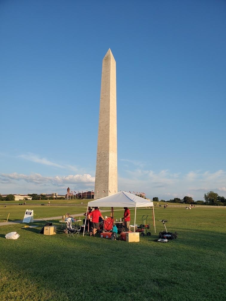
The work has taken his team from the grounds of the National Zoo to the Washington Monument, where they have used sound, radar, and electricity to try and map fault lines residing deep below the city’s subterranean environment. (That’s resistivity surveys and ground-penetrating radar to all you budding geologists.) They are also trying to obtain ground samples that have not been exposed to sunlight, in order to age the fault lines — and determine when they last may have moved.
The work has largely been done in public, and Easson says he’s attracted some attention — most of it positive. During work on the mall, he says he waved over a kid who was eyeing the team from a distance.
“In typical kid fashion, his reaction was, ‘Wow, that’s cool.’ An adult reaction is more often, ‘Who’s paying for it and what’s the point?'” he says. (In case you’re curious, USGS says the project’s funding is $78,137.)
During work on the grounds of the National Zoo last Sunday, the team used a tarp to keep themselves dry as they set about their tasks. And that prompted unwanted attention from some nearby residents — who then called the police.
“A very nice policeman came up and asked us what we were doing. Someone said it looked like a homeless encampment,” says Easson.
A few days later, the U.S. Park Police asked to check the team’s equipment before they started work near the Lincoln Memorial.
Once the team’s work is done, Easson expects it will take another three or four months to analyze all the data and properly understand which fault lines exist across the city, and whether they are connected.