Jacob Fenston
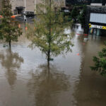
As Ida continues to batter Louisiana and Mississippi, flooding cities and leaving more than 1 million people without power, the tropical storm is now taking aim at the D.C. area. The remnants of the storm are expected to bring heavy rain to the region on Wednesday, with the possibility of flash flooding.
The National Weather Service has issued a flash flood watch for the area, in effect Wednesday morning through early Thursday morning. Flooding along the Potomac River could continue through the end of the week.
Damaging wind gusts and tornados are also possible Wednesday afternoon and evening.
 Kevin Witt, a meteorologist with the National Weather Service, says the D.C. area can expect “heavy rain for a prolonged period of time.”
“This is expected to really unfold quickly, middle of the afternoon on Wednesday, and continue into Wednesday night with locally heavy rainfall,” says Witt.
NWS predicts 3-4 inches of rain in the D.C. area, with a “reasonable worst-case” possibility of just under 5 inches. The weather service also warns there is an “enhanced risk” of tornados in D.C. and surrounding counties in Md. and Va.
D.C. Mayor Muriel Bowser announced she is activating the District’s Emergency Operations Center at noon on Wednesday, to ensure a coordinated response from D.C., regional and federal officials.
“We are asking residents to take Ida seriously and to pay close attention to the weather conditions and latest alerts,” Bowser said in a press release. “And if you are driving tomorrow, remember: turn around, don’t drown.”
Bowser urged residents to take measures to prepare, including keeping phones and other devices charged, cleaning out gutters and drains, protecting areas that are prone to flooding, and securing or moving any outdoor furniture.
In Virginia, Governor Ralph Northam declared a state of emergency, noting that counties in southwestern Virginia were already experiencing impacts from Ida. In Maryland, officials advised residents to prepare for heavy rain and extreme weather.
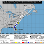
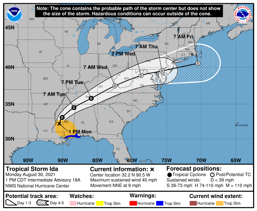
While models currently show Ida remnants tracking right through the D.C. region, impacts will depend on the storm’s precise path. If it heads a bit farther south, Witt says that would focus the heaviest rainfall squarely on D.C., bringing more than the anticipated 2-4 inches. On the other hand, if the storm tracks a bit to the north, “then we have more of an instability factor and severe, weather and tornadoes,” Witt says.
The impacts on the region could be made worse because the ground is already saturated from seemingly nonstop storms in recent weeks. D.C. has gotten 9 inches of rain so far this month — three times the normal amount for August.
There is the chance for even more rain before Ida’s arrival: A flash flood watch is also in effect Monday afternoon and evening, until 10pm.
Urban and suburban areas in the region are more at risk for flooding than many rural areas because roads, parking lots, roofs and other impervious surfaces prevent rainfall from naturally infiltrating into the ground. Instead, stormwater rushes toward the nearest drain. Pipes then convey the runoff into local creeks and rivers, which quickly fill up. In Alexandria, where flash flooding damaged homes and roads earlier this month, the Department of Transportation and Environmental Services is distributing free sandbags to residents on Tuesday morning, ahead of the storm’s expected arrival in the region.
Ida made landfall in Louisiana on Sunday as a Category 4 hurricane, with sustained winds of 150 mph, but has since been downgraded to a tropical storm.
Powerful tropical storms like Ida are made more likely due to climate change, fueled by warmer ocean water. Flood risk is also on the rise in the D.C. region as the planet heats up — the tidal Potomac River has risen 1 ft. in the past century due to climate change, and could rise another 6 ft. or more by 2100.
This story was updated to include info from Mayor Bowser and a new forecast from NWS.