Martin Austermuhle
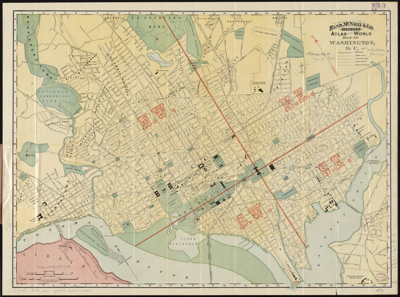
Lines have been drawn. Sides chosen. Now, we fight.
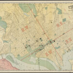
It’s redistricting season, the once-a-decade moment when D.C. lawmakers sit down to redraw the lines that determine what ward you live in — and, as a consequence, who might represent you on the D.C. Council. The process is required by law and largely technical in nature; it quite literally involves shuffling census tracts around to ensure that every ward in the city is roughly the same size, population-wise.
But redistricting also touches on neighborhood identity, race, and political power — meaning that it can lend itself to tense debates and controversy. And those may well be in play as the D.C. Council moves towards debating and voting on new ward maps later this month and into December.
Why does D.C. have to redraw its ward lines?
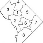
Much like states that have to redraw congressional and legislative maps every 10 years after the census, D.C. lawmakers similarly set to redrawing the city’s wards to account for population growth and shifts and to ensure that political representation is evenly spread across the city’s neighborhoods and communities. By law the population of each of the city’s eight wards has to be within plus or minus 5% of a set average. (The wards also have to be compact and contiguous, and new boundaries cannot be drawn to purposefully dilute minority voting power.)
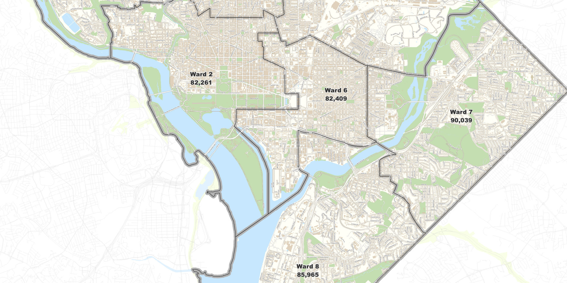
Per the U.S. Census, D.C.’s population in 2020 was 689,545. If evenly divided across the city, that would mean each ward would have, on average, 86,193 people.
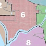
But the city’s growth over the preceding decade was uneven, with one-third of it happening in Ward 6, home to emerging neighborhoods like Navy Yard, NoMa, and The Wharf. That’s left the ward with more than 22,000 residents over the ward average, while wards 7 and 8 east of the Anacostia River have fallen far enough below it that they need to add residents to come within 5% of the average. (On the low end of the average, a ward could have 81,883 people; at the high end, 90,503.)
In short, that means Ward 6 has to shed some residents — while wards 7 and 8 will have to pick some up.
How far along is the redistricting process?
Last week the D.C. Council’s Subcommittee on Redistricting wrapped up its public hearings on redrawing ward maps, with a plan to start finalizing the new map this month in time for a pair of votes in the full council in December. By law, the new ward map has to be done by the end of the year.
Earlier this month, the subcommittee released three “discussion” maps, all of which were submitted by members of the public as part of an interactive redistricting tool created by the city. (You can see 196 other submissions here.) Those discussion maps offer pretty clear hints as to what’s going to change: Ward 8 is almost certainly going to extend across the Anacostia River, likely peeling off a portion of Navy Yard or the Southwest Waterfront from Ward 6; Ward 7 could also expand further into Ward 6, potentially moving deeper into the eastern edge of Capitol Hill.
The proposed maps would also see smaller changes in other parts of the city: parts of Shaw may be moved from Ward 6 into Ward 2, U Street may be combined into Ward 1, and the boundaries between wards 4 and 5 may shift slightly.
Councilmember Elissa Silverman (I-At Large), who chairs the three-member redistricting subcommittee, says they tried to make the process as transparent as possible — there were 11 public hearings, including one for each ward, and more than 200 people were able to submit suggested maps for consideration. (Some may have been slight wishful thinking; one would have created 12 wards.)
“I felt like the process in the past has been a very closed-door backroom process and I wanted it to be a participatory process,” she says. “We are trying to make this a transparent, accessible process where no one is going to be surprised about the decisions that need to be made.”
So how big a deal is redistricting really?
That’s the $86,193 question.
To be clear, for an overwhelming majority of D.C. residents, redistricting doesn’t mean much at all — their homes are safely ensconced in a particular ward, and changing that would take some radical redistricting acrobatics that won’t happen. If you live in wards 1, 3, 4, or 5, you’re likely to see no changes at all — or maybe a minor nibble around the edges.
Additionally, it’s worth noting that unlike in the states where the redistricting process can shape or outright determine the makeup of a congressional or legislative delegation (a fraught move, especially in these highly partisan times), redrawing ward lines in D.C. has less of an actual political impact — mostly because the city is so overwhelmingly Democratic. (That’s not to say that there haven’t been sneaky maneuvers in the past to protect certain neighborhoods or elected officials from being moved to another ward.)
That being said, redistricting always sets off some fights and controversies — many of them founded in the interrelated issues of neighborhood identity, race, and political power.
In 1981, Georgetown fought being moved from Ward 3 to Ward 2, in part over concerns that the majority white and wealthy neighborhood would be merged with what were then more diverse areas in Dupont Circle and Shaw. When portions of upper Northwest were moved from Ward 3 to Ward 4 in 2001 — thus expanding Ward 4 across Rock Creek Park for the first time — some Ward 3 residents said it would dilute Black voting power in Ward 4. But others countered that the wealthy Ward 3 residents were making excuses for not wanting to be associated with Ward 4 and its higher proportion of Black voters. That same year, some Black residents east of the Anacostia River protested the plan to pull Ward 6 fully west of the river (it used to include a small sliver east of it), saying they would lose voting power by being limited to only wards 7 and 8.
In 2011, residents of Ward 6’s eastern-most neighborhoods successfully fought a move into Ward 7. (“Hell no, we won’t go to Ward 7,” read one sign at a protest.) That same year, the late councilmember Marion Barry unsuccessfully pushed to expand Ward 8 across the Anacostia River, which he said would carry both symbolic and political weight for the city’s most disadvantaged area.
Barry is gone, but this year his hope is very likely to become a reality. But how that happens is what’s provoking some local angst. As noted, one of the possibilities is that Ward 8 would grow to include the portion of Ward 6 in Southwest (which includes The Wharf and the residential areas around it). For some residents in Southwest, that’s a non-starter; they say their community is distinct from Ward 8, and worry that moving wards would potentially leave them politically isolated. (Others simply want to make sure Southwest isn’t broken up between two wards.) Much the same goes for some residents on the east end of Ward 6 who are again fighting a possible move into Ward 7 — they say they are more closely linked to Capitol Hill than they would be neighborhoods across the river.
On top of that, there are concerns that splitting off Southwest or the eastern edge of Capitol Hill would leave Ward 6 much whiter than it is now. Other residents have urged the council not to split neighborhoods up between different wards (Silverman says the goal is not to), but even that can be complicated since neighborhoods are often more a concept than a formal set of boundaries. (Think Capitol Hill, which can be thought to encompass a central portion of Ward 6.)
“It’s a real threat to people’s identity,” says Corey Holman, a Ward 6 ANC commissioner who followed the process extensively and submitted one of the maps the subcommittee chose to spark discussion, about why redistricting can be a contentious issue in D.C. “We’re not building walls, we’re not kicking them out of the city. It’s just that part of their identity is being challenged.”
And then there’s the contentious issue of parking.
Wait, what does parking have to do with redistricting?
In the past, a lot.
As with almost every other urban debate, parking is a potential flashpoint in any redistricting process — specifically the fate of residential parking permits, the stickers residents pay for that that give them free and largely limitless parking in residential areas of the ward they live in.
In some wards, those permits are a really nice perk; think of living in the outer reaches of Ward 3 but being able to park for free a block from the Woodley Park Metro, or living on Capitol Hill but being able to park nearby nightlife hotspots along H Street or by the waterfront. That’s the power of the residential parking permit.
This time around, though, the lawmakers leading the redistricting process wanted one less headache, and decided to remove parking from the equation altogether. Current residential parking permits will remain the same under the new ward map as they are now. “We will keep the parking status quo,” says Silverman. (So even if the Southwest Waterfront is shifted into Ward 8, residents there will keep Ward 6 RPP privileges.)
That’s not to say that the parking areas will never change, though. The council could separately consider legislation that would link residential parking permits to a resident’s Advisory Neighborhood Commission district instead of ward.
Will any of this impact police service or schools?
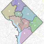
Not really. Police districts and police service areas, for one, are a separate sets of maps. In most cases, the seven police districts will broadly coincide with wards, though not necessarily the ward numbers. So while the Fifth District covers much of Ward 5, it’s the First District that covers Ward 6. (This is because there are seven police districts for the eight wards; wards 2, 3, and a part of 4 are lumped into the Second District.) Those maps are redrawn on a different schedule that isn’t tied to the redistricting process.
That also goes for the boundary maps that determine where kids go to school; they were last redrawn in 2014, and could see another reworking as early as next year. And it’s probably a good thing all these changes don’t all fall at the same time; if you think redistricting can be contentious, just wait until you see how politically sensitive school boundaries can be.
How about Advisory Neighborhood Commissions?
If redrawing wards lines wasn’t enough to whet your appetite, the process of redrawing Advisory Neighborhood Commission lines should.
ANCs are the District’s grassroots form of democracy, almost 300 elected volunteers who represent districts of 2,000 of their neighbors. Once the new ward lines are approved (which has to happen by the end of the year), individual ward-based councilmembers will lead the process of redrawing ANC boundaries and, in some cases, creating new ones. That, of course, will spark its own fights, largely involving slightly smaller political fiefdoms and the significant amount of power that sitting councilmembers have to reshape or expand them.
So what’s next?
At some point in the next two weeks, the redistricting subcommittee — along with Silverman, it’s made up of At-Large councilmembers Christina Henderson and Anita Bonds — will hold a public markup session where they will finalize their proposal for the new ward map. On Dec. 7, that map will get a full debate and vote in the council, followed by a second and final vote on Dec. 21.