 Jordan Pascale
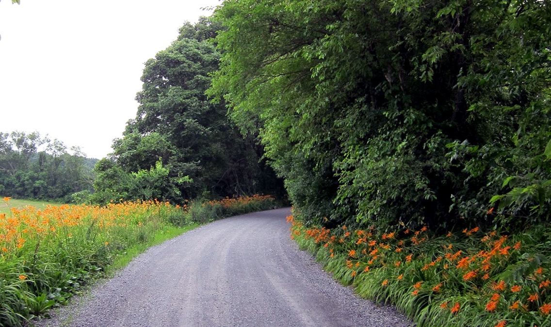
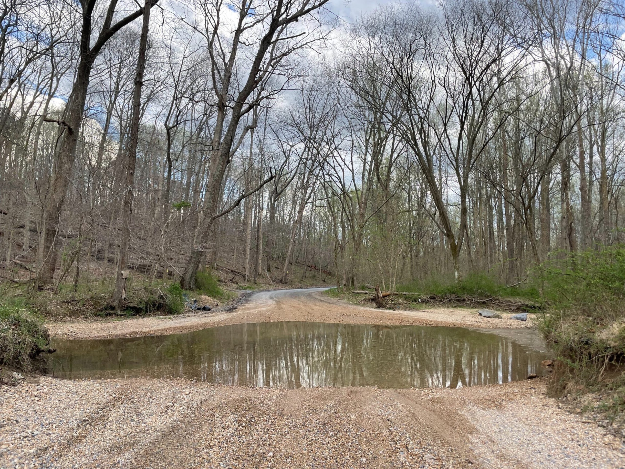
When you think of roads in Montgomery County, your mind may jump to the wide and fast corridors like Georgia Avenue or Rockville Pike, but head upcounty and you’ll find some of the most serene, beautiful driving and biking in the region. One-lane gravel roads winding through wooded areas like Mt. Ephraim Road, or one of the still-unpaved early 1800s roads like West Old Baltimore Road where vehicles have to ford a stream.
Montgomery County, the second largest in the region at 507-square-miles, is home to 99 of these “rustic roads” which, to earn the distinction, must be historic, have scenic views, and reflect the agricultural character and rural origins of the county. They tend to be narrow, low-traffic, and highlight historic areas. A second distinction, “exceptional rustic road” requires unusual features found on few other roads like ruins or historic homes
The rustic roads program was started in the 1990s after county planners found that more and more historic roads were turning into suburban-style thoroughfares. It was last updated 18 years ago. Now planners are in the process of refreshing the map with 20 new additions suggested by residents. The document also includes photos and descriptions, additional references to previously under-represented groups and places, and notes threats to the roads due to climate change.
You can find a pdf map of the county’s rustic roads here, as well as an interactive map with proposed additions here. Most of them are in the agricultural reserves around the Poolesville area between the Potomac River and I-270. Others are in the Olney, Damascus, and Clarksburg areas.

Last week, the county’s planning board reviewed the plans. The board is expected to approve the nominations and changes later this year.
Planning board member Carol Rubin said the resource should also be turned into a tourism guide to help market the county to visitors. “There are a lot of people who really enjoy that aspect of traveling around the county or even visiting the county to learn about the history,” Rubin said, “and this is a great opportunity to do that.”
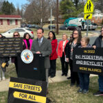
Many cyclists praise the low-trafficked gravel roads as a safe space to ride. But planning board Chair Casey Anderson also brought up the safety of the roads while preserving their historic qualities.
“Sightlines on some of these roads are not such that you have good visibility of oncoming traffic in some cases,” Anderson said. “And so I can say… just anecdotally from my experience, some of these roads are not built to standards that you would expect if they were built today. That’s not to say that should all be straightened out or that they should not be preserved.”
“Rustic” may sound like a scary situation in terms of safety, but all the roads do have to be safe for travel, planner Jamey Pratt said. Some of that discussion should be had now, he said, as well as how the rustic road plan overlaps with other priorities like a bike and pedestrian master plan, and the complete streets plan that calls for roads to be friendly to all types of travel.
“You know, is that separated bike lane appropriate on a rustic road? Maybe it is, maybe it isn’t. We need to talk about it and decide if it is appropriate,” Pratt said. “(If so) what should it look like?”
The planning board also noted that more neighborhoods, wineries, and breweries are sprouting up in the agricultural reserve, which is adding some traffic to these roads. This, in part, led to the planning board’s ask for a map of crashes on rustic roads.
Video above by Rustic Roads Advisory Committee member Barbara Hoover.
One of the proposed changes to the rustic road map will be to include additional parts of Brighton Dam Road near Brighton, which was an early postal road that includes historic sites like the Brookeville Woolen Mill and Prospect Hill.
Planners say one road, Link Road, should be removed because it has become so developed that it lost its historic character.
They also are revamping and modernizing the description of the roads and things nearby. For instance, the 1996 version of the document “overly glorified” Confederate officers who lived near one road, says Pratt. He was referred to as a “local hero” – but Pratt said he wasn’t a hero to some, so they changed it to “he fought for the Confederacy.”
“We looked at every one of the existing road profiles to examine whether the language might need to be updated to be more equitable, especially when it concerned the issue of slavery and people whose wealth was built on an enslaved workforce,” Pratt said during Thursday’s meeting. “We’re just trying to tone that language down and make it a little bit more fair to everyone who contributed to these, these rustic roads and their histories.”
“We also looked at some underrepresented communities along these roads to perhaps see if we could bring forward the histories of those communities.”
Holly Grove Road was one new addition. A historic African American community grew along the road right after the Civil War. Some of the original descendants of the families that lived along the area still live there, planner Roberto Duke said. Another rustic road, Pennyfield Lock Road, was updated with references to Tobytown, a historic African American community. The description will now include the names and dates of when the community was founded.
Game Preserve Road, near I-270, now includes information about Emma Jane King, the first female game warden in Maryland who lived along the road.
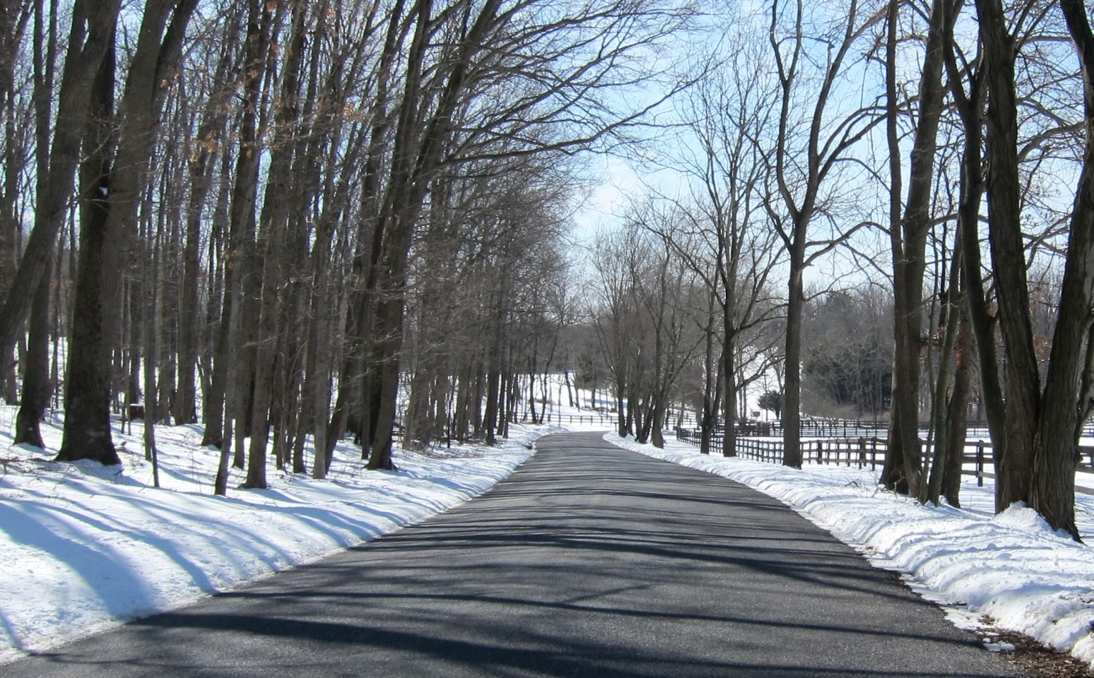
The updated plan also notes specific concerns about the effects of climate change on old bridges and one-lane roads. Some have become more damaged because of frequent flooding.
The Planning Board will hear more about the rustic roads plan this summer before it gets moved up to the County Council for a vote.