Hurricane Earl has worked itself up to a Category 4 storm, sitting just off the coast of Puerto Rico at 7 a.m. this morning, and with winds reaching 135 mph. There were some rumblings that Earl might be the next Isabel, maintaining strength and working its way up to hit us here in D.C., but those worries seem to be unfounded. NOAA’s National Hurricane Center has Earl continuing to sit off the East Coast in the Atlantic, possibly making landfall when it gets to North Carolina. By the time it reaches Washington later this week, the storm should be considerably weakened. The Capital Weather Gang is making weekend picnic plans, stating that “a sizable cold front is forecast to act like a pinball flipper and knock Earl back out to sea. Then a first-class weather weekend arrives!” So no need to batten down the hatches quite yet, Washingtonians. We’re sure Pepco is breathing a sigh of relief.
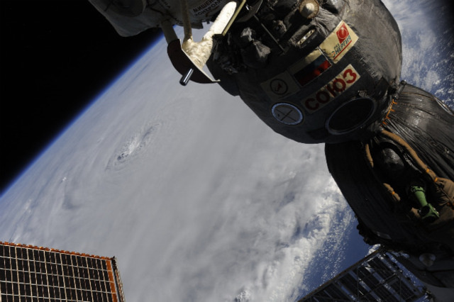
Check out the images above of the powerful Earl from last night, dating back to when it was just a tropical storm. The first two were taken aboard the International Space Station by NASA Astronaut Douglas Wheelock (you can follow his mission aboard the ISS and see more photos by following him at @Astro_Wheels). As he notes, check out the huge difference in that short time between yesterday morning and yesterday evening. The second pair are from two of NASA’s Earth Observatory satellites, Terra and Aqua, with the final image taken four days ago when Earl was just an amorphous blob with potential. Finally, take a glimpse at NASA’s Image of the Day from the GOES-13, featuring both Hurricanes Danielle and Earl — and a third storm gaining strength.