Martin Austermuhle
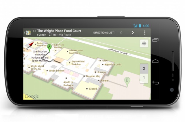

A new app for Android users will allow tourists and direction-averse residents to more easily get around the various museums of the Smithsonian Institution. The Smithsonian announced today that a Google Maps on Android-enabled phones will include maps of the institution’s museums:
Beginning today, many of the millions of yearly visitors to the Smithsonian can electronically explore the building interiors, floor by floor, and pinpoint themselves within the building. The technology allows visitors with Google Maps for Android to navigate within and between each museum.
Users will see themselves on the map as a blue dot that will show their location and orientation within the context of exhibits, stairs, restrooms, eateries and other features. Step-by-step walking directions between destinations are also available within the app, providing visitors guided navigation within each museum.
The maps cover 19 different museums or galleries, all but two in D.C. (It includes the Udvar-Hazy Center in Chantilly, Va. and George Gustav Heye Center of the National Museum of the American Indian in New York City.) The maps include “several hundred clickable points of interest and stand-alone objects” which can be used to set destinations.
Google recently teamed up with the White House on an online tour of the East Wing.