Martin Austermuhle
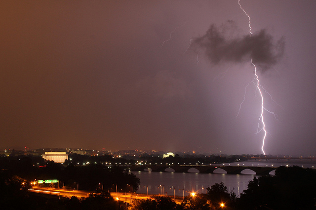
 Photo by BrianMKA
The derecho storm we experienced on June 29 isn’t the sort of things we’d want to see twice in the same number of months. The storm—basically a hurricane without the swirling—battered the city, downing trees and power lines and knocking out power for tens of thousands of households.
There’s currently a derecho hovering over parts of the Midwest and as far east as West Virginia, and as the Capital Weather Gang notes, the “overall configuration of weather systems resembles that of June 29, when the derecho struck the mid-Atlantic.” So yeah, that’s no good.
But they warn that they’re not yet convinced that we’ll see another derecho—just merely some very strong thunderstorms. The National Weather Service just put out a Severe Thunderstorm Watch through 8 p.m., during which we can expect large hail, lightning and thunder and winds gusting up to 75 mph. We may be just north of the worst of it, though.
So as usual, keep your eyes peeled and quickly make for the indoors if something comes rolling in.