 Via Google
Two years ago, Google and the Washington Metropolitan Area Transit Authority finally broke bread and introduced train and bus schedules into Google Maps. It was an overdue innovation, but a welcome one that made it much easier for people to navigate their ways around D.C.
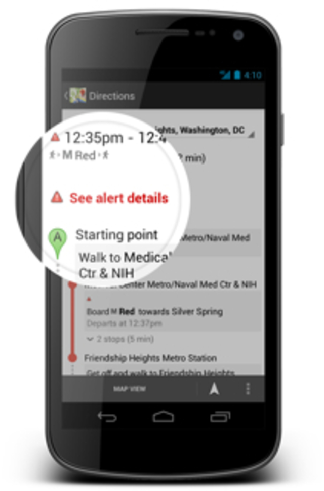
But transit schedules only work so well, and when something goes awry—as happens often enough on Metro—the listed arrival times can be fairly useless. That’s changing today, as Google Maps will now list Metrorail advisories when giving directions, Google announced on its transportation blog. The search giant will be taking into account repair and delay data uploaded from Metro’s headquarters and including them when calculating the ideal route to get around town.
It’s especially useful for people who are already in transit and encounter an unexpected spot of track work or out-of-service train. Metro information appears readily in the mobile versions of Google Maps, while users of Apple’s iOS map program—if there are any users of that wobbly app willing to identify themselves—must do without realtime transit information.