 Rachel Sadon
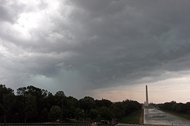 Photo by Ian Livingston.
Update: There is a tornado watch in effect until 10 p.m. From the District of Columbia AlertDC system:
National Weather Service has issued a Tornado Watch for the National Capital Region until 10 pm this evening. There is a possibility of 70% chance scattered severe thunderstorms mainly between 6-8 pm with totals of ½ inch (expected) and 1 inch (on high end).
Original:
Spring giveth and it taketh away.
It may be utterly perfect outside now, but a severe thunderstorm is probably on its way over to ruin things.
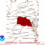
According to the National Weather Service’s hazardous weather outlook for D.C., northern Virginia, and Maryland: “Thunderstorms are likely late this afternoon and evening. A few of the thunderstorms may become severe with a threat of damaging wind gusts … large hail and an isolated tornado.”
via @NWS_BaltWash: Enhanced risk of severe weather this PM. Be prepared for damaging winds, hail, heavy rain. pic.twitter.com/6EQqu6ePHc
— Fairfax County (@fairfaxcounty) April 20, 2015
The NWS Storm Prediction Center categorizes our area as at an “enhanced risk,” the third-highest of five thunderstorm risk categories.
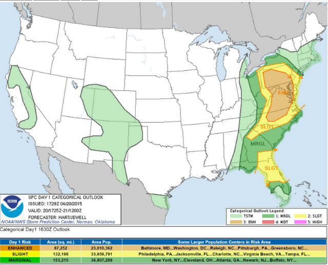 Via NWS.