Jacob Fenston
Remember the Great Potomac Flood of 1936? Or the record-breaking 1942 flood?
It’s one thing to read about past storms, or see photos of historic flooding. It’s another to stand next to buoys floating mid-air showing historic flood levels, and then look up to see buoys overhead, representing how high future floods could be.
A new sculpture at the Wharf communicates D.C.’s flood risk in a visceral way.
“It just relates it to your body, right?” says Patrick McDonough, one of the D.C.-based artists who created the piece. “What I’ve noticed in my times down here is people really like looking up, relating to themselves and then thinking back to these historic moments.”
The sculpture, called “High Water Mark,” was officially unveiled at a recent ceremony.
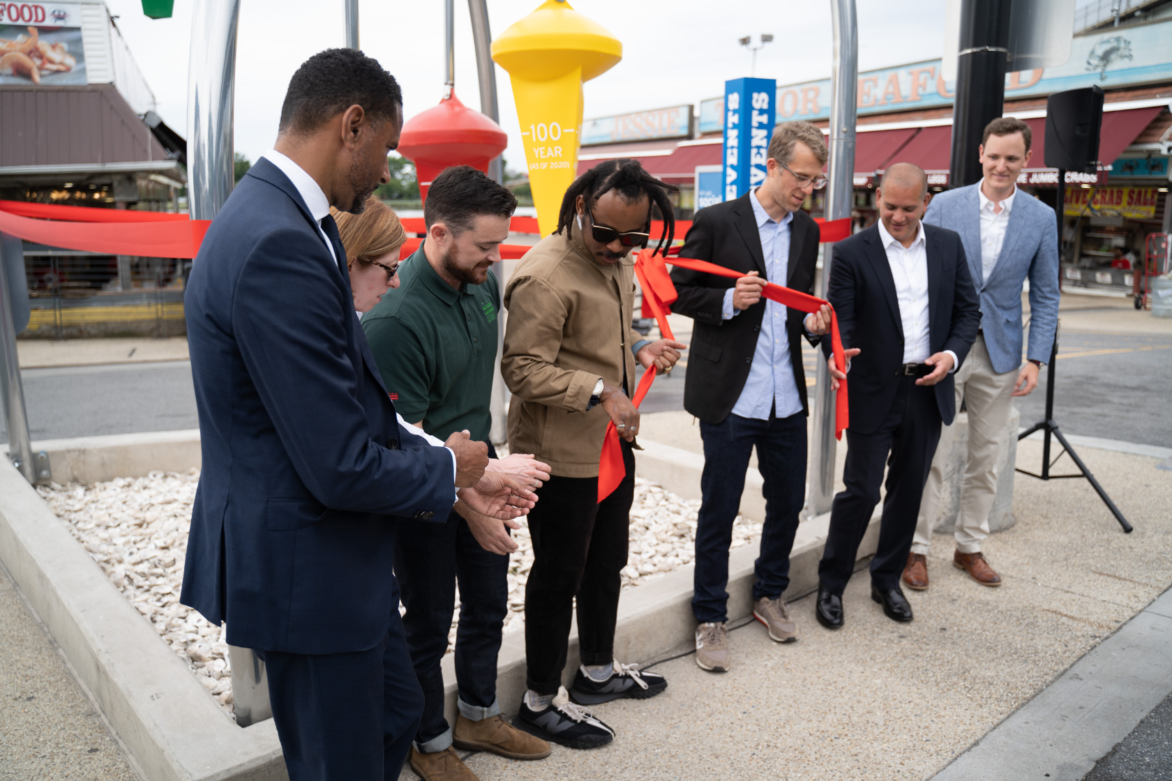
Artist Curry Hackett, the other collaborator on the project, says he hopes passersby at this busy spot on the waterfront stop to contemplate the colorful, playful sculpture and the risk of disaster that it represents.
“I think humans are not that great at planning for the future,” says Hackett. “A piece like this that’s spectacular and that can really kind of image that risk, I think is really important work.”
D.C. is vulnerable to three different types of flooding, and all three are being made worse by climate change and sea level rise.
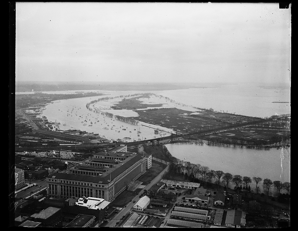
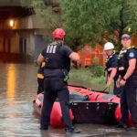
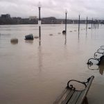
Floodwaters can come from upstream — even if it hasn’t rained much in D.C. — as stormwater flows down through the Potomac watershed. That’s what happened in March 1936, during one of the city’s worst floods on record. Much of the D.C. area saw less than an inch of rain, but areas upstream got 5 inches or more. This is known as riverine or freshwater flooding.
D.C. can also flood due to coastal storm surges, when a hurricane or tropical storm pushes water up the Potomac. Even areas of the city far from the rivers can be inundated due to what’s known as interior or urban flooding, when a storm dumps lots of water on the city in a short period of time, overwhelming drainage systems.
Higher sea levels mean more areas will be vulnerable to riverine and tidal flooding, because the rivers are already at a higher level when a storm hits. The Potomac has already risen about 1 ft. since the beginning of the 20th century, and officials are planning for potentially another 4.5 ft. of sea level rise by 2080.
In addition, the changing climate, bringing more frequent and stronger storms to the region, will also make flood risk worse.
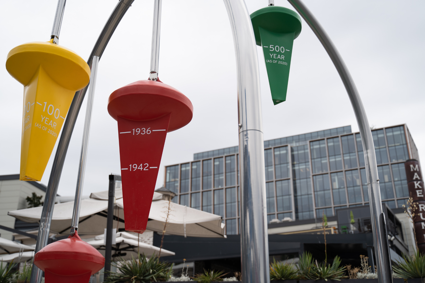
The sculpture depicts flood levels of five historic storms at the exact spot where the piece is located, at the edge of the Municipal Fish Market. It also has buoys representing the levels of a so-called 100-year flood and a 500-year flood. The 100-year buoy is suspended 6.2 ft. above ground level, while the 500-year buoy is 9.6 ft. above ground.
A 100-year flood is one that has 1 in 100, or 1%, chance of happening in any given year. A 500-year flood has a 1-in-500, or .2%, chance of occurring. But those numbers are shifting: a storm that historically had a 1-in-100 chance of happening is expected to have a 1-in-15 chance by 2080.
The Wharf, a $3.6 billion development along one mile of riverfront, was constructed with buildings’ first floors above the 100-year floodplain. The development also has large underground cisterns to mitigate flooding, able to hold as much stormwater as an olympic swimming pool.
But such protections will not be enough as the sea level rises. Nicholas Bonard, with the District Department of Energy and Environment, says D.C. officials are currently exploring the idea of requiring new buildings to withstand 500-year floods. “The intent behind that is to say, look, we know that the 100-year floodplain in 2080 is probably going to look more like today’s 500 year floodplain. And this is just because of sea level rise and climate change.”
This sculpture is the third, and most prominent, piece Hackett and McDonough have created for the city to show flood levels. The other two are simpler — 12 ft. tall poles, with rings showing flood levels. They are located at Kingman Island and Marvin Gaye Park. The $98,000 project is funded by DOEE and the Federal Emergency Management Agency.
This story was updated to correct the spelling of Nicholas Bonard’s name.