 NASA image courtesy MODIS Rapid Response Team at NASA GSFC
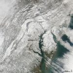
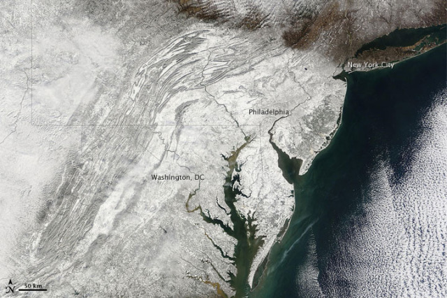
After seeing this incredible image in December, we kept our eyes peeled for photography from NASA’s Earth Observatory of last weekend’s snowstorm, and weren’t disappointed. The Terra satellite, which just celebrated ten years in space recording climate change, took this image on Sunday with the onboard Moderate Resolution Imaging Spectroradiometer (MODIS). The snow really highlights the topography around the Appalachian Mountains. NASA has been working models of today’s coming storm to compile a projection of what the region will look like tomorrow, seen here. It’s nice to know we’re doing our part in the Mid-Atlantic to provide lots of data for NASA’s Natural Disasters page.