 Photo courtesy DCRA.
Last October, the city’s Department of Consumer and Regulatory Affairs released a large set of maps which were uncovered at the District’s Office of the Surveyor. At that time, the agency said that they had hoped to release more maps in the following weeks, but they got held up — I heard there was some kind of big governmental transition that happened around town, or something. But the agency is back at it now, uploading at least one map a day as part of “March Mapness.”
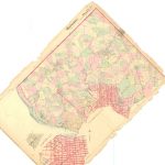
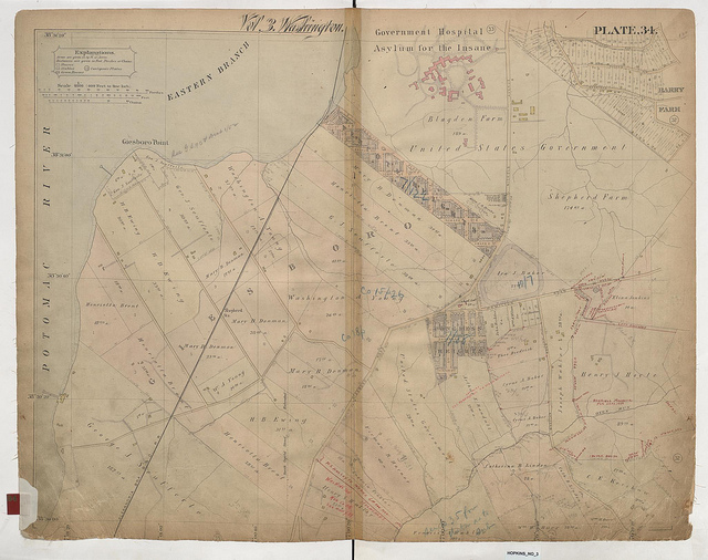
The map above, one of the entries uploaded to Flickr on February 28 (be sure to check out the high-res version to get an appreciation for the detail), is a representation of the Barry Farm and Congress Heights neighborhoods, as well as St. Elizabeth’s — which at that point was called the “Government Hospital Asylum for the Insane.”
We’re told that DCRA will be uploading more maps throughout March, so go check ’em out if you’re into historical cartography.