

Maps are cool. We’ve written about them many, many times and even made our own. Free stuff is also cool. We’ve written about that too. So you can guess what we think about free, downloadable historical maps of D.C. We love them.
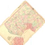
Browsing around on Flickr the other day, we saw that user PGCist had posted a fascinating 1861 map of their namesake: Prince George’s County. Following the link in the photo’s description, we found the Library of Congress’s American Memory Map Collection. Put in a keyword or just browse around the site and you’ll find lots of interesting maps. The collection has everything from a map of D.C. in 1791 to Civil War maps to maps of different cities from a variety of time periods. The one pictured above is from 1793, and there’s even a Dutch version. We like “Oost Capitool Straat” in particular.
They’re all downloadable in JPG2000 or MrSID formats, which are readable with a free program the site links to, Irfanview. With that, you can convert it to JPEG or other, more common formats. It’s easier than it sounds. Most of the maps are poster-sized, but can be resized and perused (and printed) to your heart’s content.
1793 map from the Library of Congress

