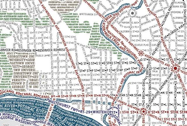

Now, we try not to do too much hawking on this here blog, but, occasionally, like with the District coffee table and the print of D.C. as a Pop Tart, we just can’t help it. That said, check out this map, created by Axis Maps, which “accurately depicts the streets and highways, parks, neighborhoods, coastlines, and physical features of Washington DC using nothing but type” culled from OpenStreetMap. (There’s also similar maps available for New York, San Francisco, Chicago and Boston.) According to Axis, “every single piece of type was manually placed, a process that took hundreds of hours to complete.” Wow.
If you can forgive the creators for omitting a large section of the city east of the Anacostia River at the expense of Arlington, you can pick up a semigloss print of the map for thirty bucks.